
Madagascar, a name that evokes adventures and exotic places, scents of spices, atmospheres and environments different from the familiar ones. What idea do we Europeans have today of this island in the Indian Ocean, the scene of an extraordinary evolution defined by the French botanist and naturalist Philibert Commerson as the “promised land of Naturalists”?

How to organize your motorcycle trip through Madagascar
Being the only large urban area and probably the only true city on the island, almost all tourists land in Antananarivo. The capital is at the center of the country and along the main communication route: the Route National 7 or RN7. Nevertheless, many choose internal flights to move around the country and there is a reason for that.

Most of the roads around the country are in terrible condition, and many sections of the RN7 are no exception: although asphalted (for the entire stretch from Tana to Toliara for what I’ve seen), it’s a one-lane road in each direction and in some areas it’s plagued by dangerous potholes. This has two important implications for what concerns your road trip: you need to choose a bike and plan your trip accordingly.
Renting a bike
Before this trip I gave some thought about Namibia, only to give up in the face of the lack of economically viable ways to rent a motorbike: before trying to draw your itinerary on a map, it’s necessary to verify the actual possibility of having a vehicle available for your journey. In some countries, motorcycle tours are something rather new and the possibilities to rent a motorcycle are few. Madagascar is no exception.

After after meticulous research with some ups and downs, I managed to find a few tour operators dealing with motorcycle rental and I decided to contact the following:
Moto Tour Madagascar
2WheelTravel
FlashMoto
RandoRaid (in Antsirabe)
How's your French?
First two on the list, no answer. The third one was fun. Not many in Madagascar speak English: even with the tourist information office or with the hotels be prepared to write in French if you do not receive an answer to your email written in English. After two unsuccessful emails in English, I armed myself with Google Translate (my French is not at an acceptable level) and finally got an answer. I wrote again a couple of times, asking if we could speak English, nothing. So I switched to Whatsapp, same script: French -> answer, English -> ignored. Finally he asked me if I needed a guide for my tour. No thank you.
The motorbike I got

The fourth on the list, Rando Raid, was very kind. Although the workshop was located in Antsirabe, a town a few kilometers south of the capital and it was necessary to take a van and pay an advance, I decided to rent the motorbike from him. Jean Marc, the owner, is a very helpful and nice person and has a modern and well-equipped workshop in the town center. The bike, a Pacific 200cc, was in excellent condition, indeed, basically new. I think Pacific is a local brand that makes dirt bikes roughly similar to Honda CRFs using Chinese 2-stroke engines. Though not very fast, that kind of bike was absolutely the most appropriate thing to travel on the roads of Madagascar.
Planning your trip
Unfortunately, if the condition of the national road RN7 is not very good, the others are in such conditions that a journey of many kilometers is not feasible. Most of the roads leading off the RN7 are full of potholes or, much more often, dirt roads. And believe me, it is a kind of dirt road that you will not want to travel on a motorcycle for long stretches: stones, uneven ground and sand are frequent. Fortunately, one of the most popular tours is the one that goes from the capital down south to Toliara and the end of the RN7 on the coast: the tour of the highlands.
I was advised against by many to head north on the RN7 to the tourist resorts of Antsiranana / Nosy Be. If you want to visit the beautiful north coast, the best idea is to fly to Antsiranana and rent a motorbike there (I think something is available). The tour of the highlands is however very interesting for the beautiful landscapes and the variety of environments that you cross. In addition to the fact that it does not present major difficulties. Unfortunately, for the reasons described, there is no way to plan a circular itinerary and it will be necessary to retrace the road backwards to return the bike. At the time, there was no possibility to leave the bike in another place and then be able to return by plane.
Ambo-something

One of the things you will notice when traveling through Madagascar is that most of the places are called Ambo/a-something or Anto/a-something. Which makes it a bit difficult to find your way around and remember the names of places. Don’t worry, following the RN7 down south from Tana is very easy as there are no alternatives. Only in some towns like Fiana for example, you will need the navigator at a couple of intersections, or to find the hotel. The advice is always to download the necessary maps in advance on your phone or navigator.

Police
Police and gendarmerie checkpoints are a constant along the RN7. Generally, it consists of a kiosk with a couple of chairs and a sign: you always pass without problems, just slow down a bit. Unfortunately, it seems that the stories about police extorting truck and bus drivers seem to be true, but as far as tourists are concerned, it is very rare to be stopped. It happened to me twice around Toliara. I don’t know if all the documents were in order but policemen are very kind with tourists and I got away with it quickly. If you have a European driving license, don’t bother getting an international one: it’s useless here and a waste of money.
Antananarivo

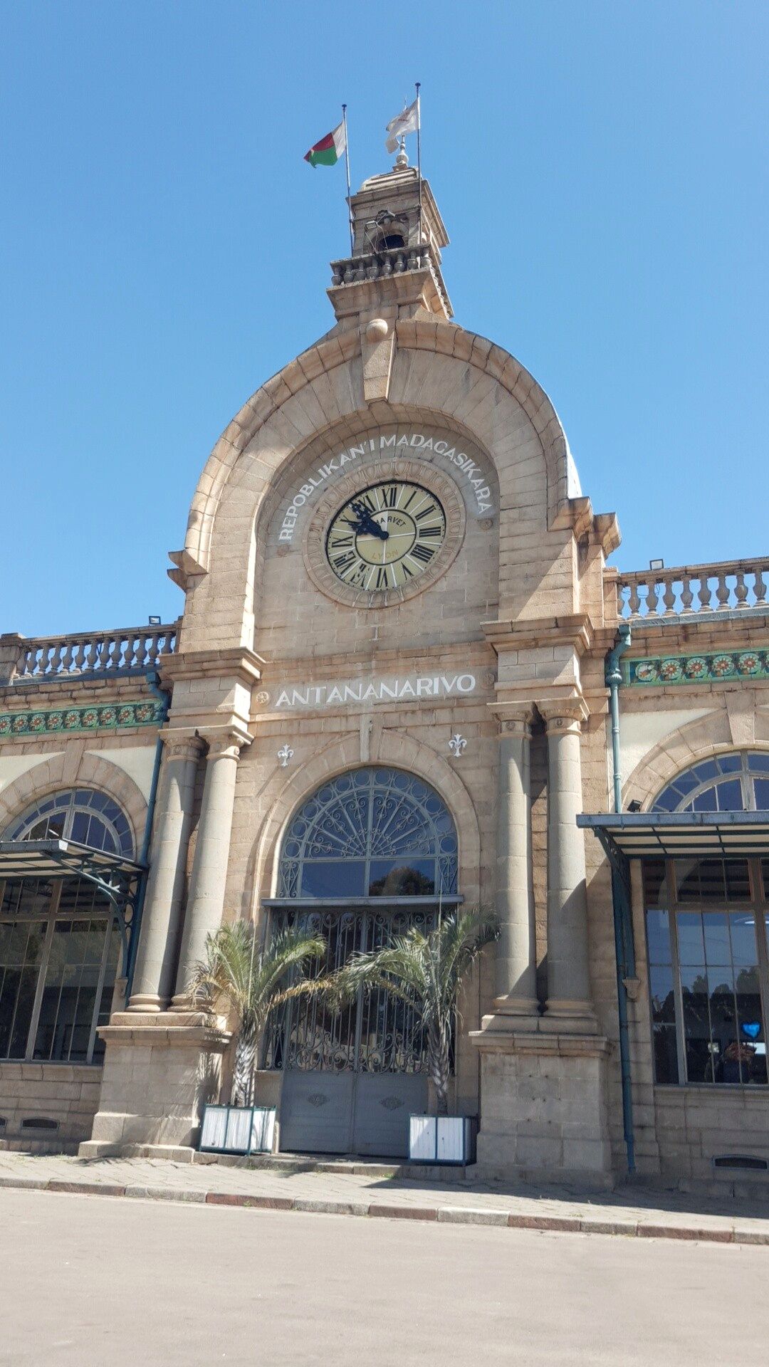
Antananarivo, with its two million inhabitants is the only true metropolis of Madagascar and probably worth taking a day to take a tour. The city is distributed on some hills so it’s difficult to frame it all with a glance. It has a lower and an upper town (Haute Ville). The Avenue dell’Independance starts from the beautiful station and is probably the main course of the lower city, unfortunately a bit spoiled by dirt, garbage and chaos like the rest of the city.

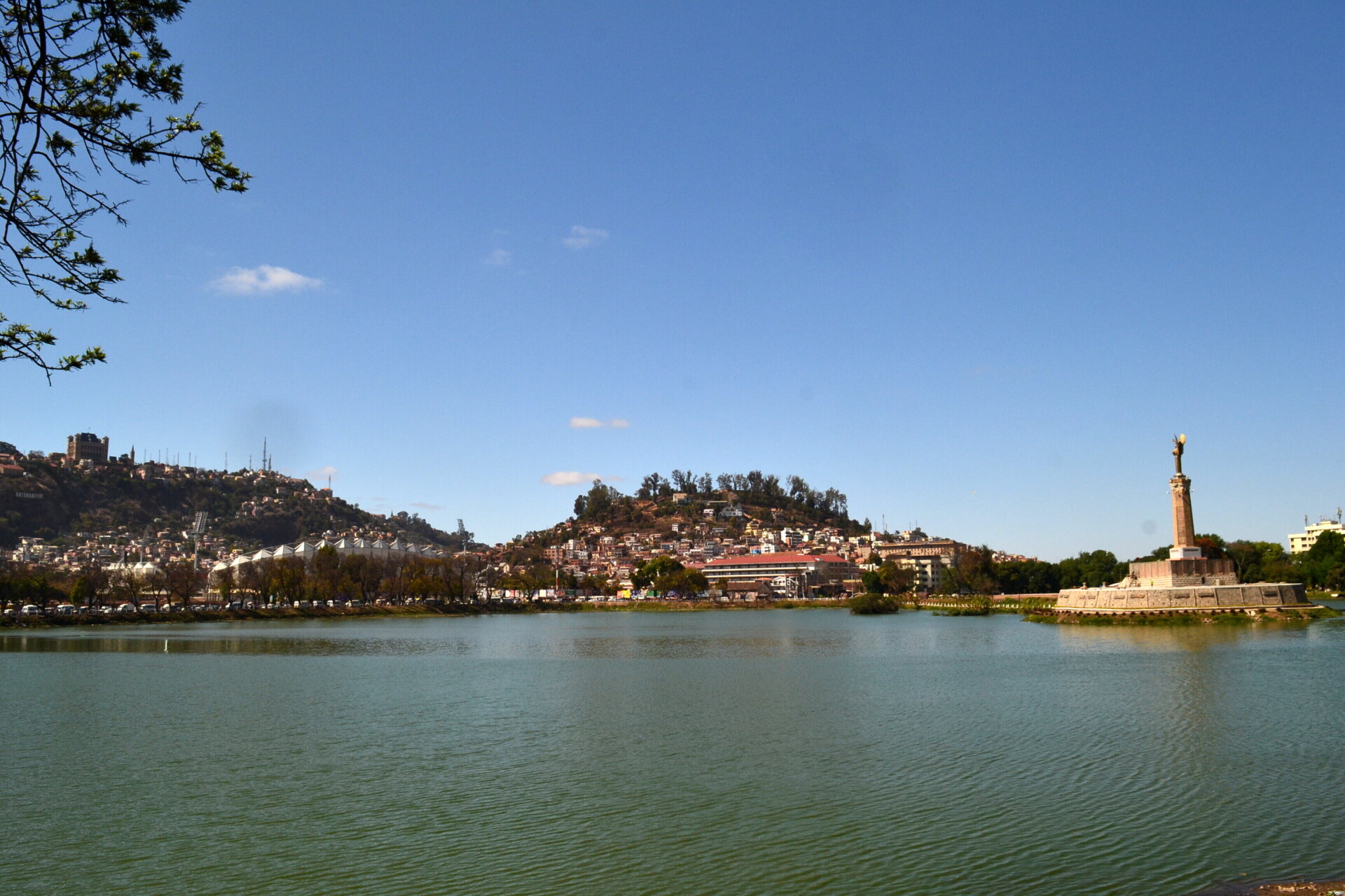
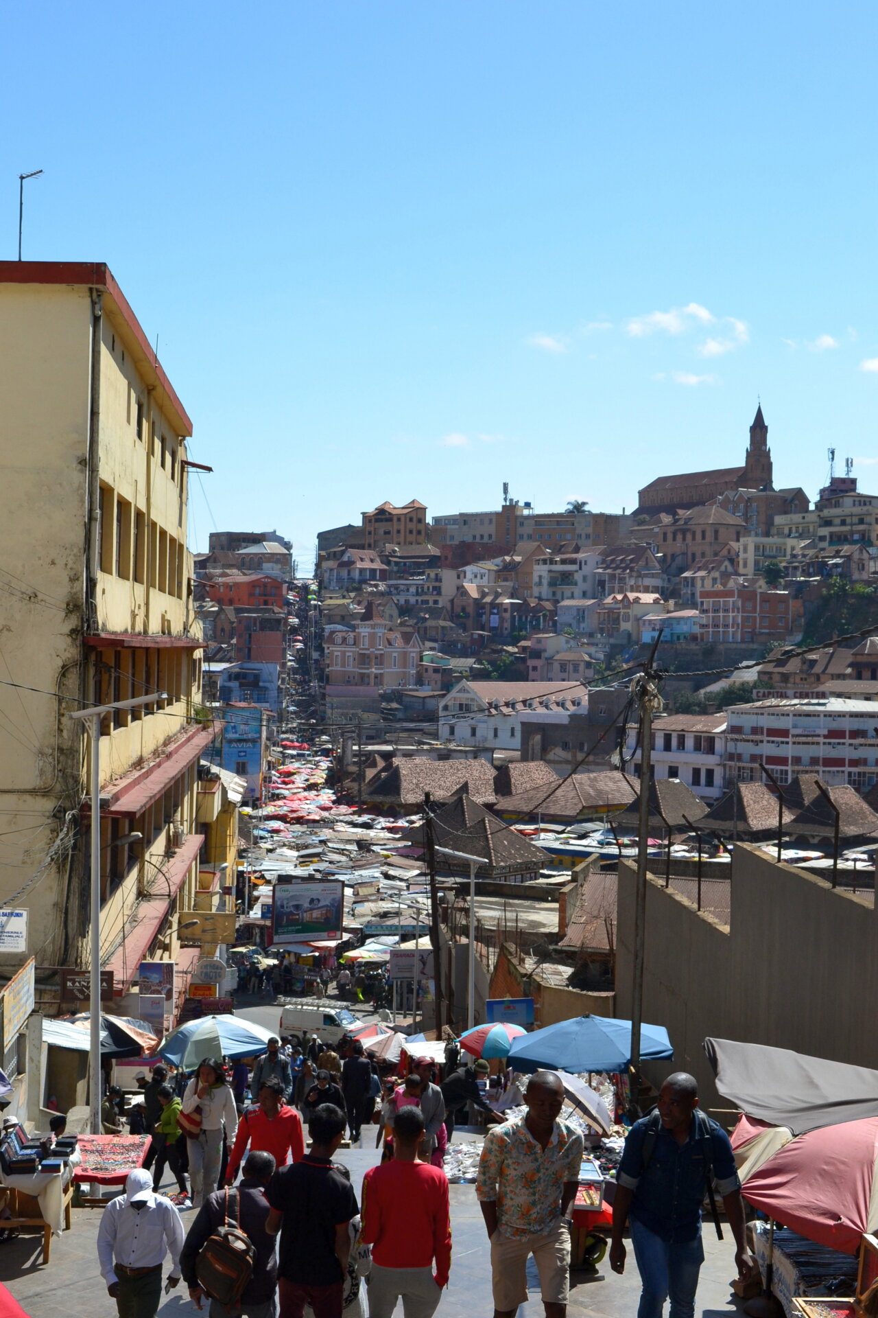
From there you can easily reach the market and the staircase going up to the upper town, where you could find some interesting things to visit: the Rove, the Queen’s Palace, the Presidential Palace, the Andohalo church, the Anosy district with its lake. I didn’t have time for an extended visit, but around the capital it might be worth visiting the Andasibe-Mantadia National Park and Andranomandraotra Geysers.

Tana → Antsirabe
Each corner of the island has something unique to offer. The middle: gentle hills, red soil and incredibly green rice paddies, mountains, rain forest. Heading south you pass through a region that looks like a mosaic of lands of different colors: amber, ocher, green, red. The houses appear to be made of the exact same material as the earth they stand on.

The landscape outside the capital to the south immediately becomes rural. The suburbs of Antananarivo are dotted with houses and rice fields. Often you can see piles of bricks on the sides of the road, near improvised ovens used for cooking them or clothes lying on the grass to dry near rivers and rice fields. In the first part of the journey the landscape is quite conventional and the traffic is relatively intense, with many trucks and vans to overtake. Getting to Antsirabe will take around 4 hours of travel.

By van
I traveled this stretch of road by van. As mentioned, the bike was waiting for me in Antsirabe, so I proceeded to book a bus trip to there, not without difficulty. There are various comfort-bus companies to check: Antsirabus, Gasy Car’s, Soatrans, Cotisse. None of these allow you to pay via the web, their websites are often malfunctioning and getting information via email is often frustrating. If you are in my condition, I suggest you to do this: arrive in Tana, allow yourself one day to take a tour of the capital and go in person to the office (which is often found at the reception of some modest hotel) to book your trip.

Antsirabe → Fianarantsoa
Although the town is far from large, with a single main road running through it, Antsirabe is an important economic center where mainly cereals are traded (and where the popular THB beer is produced). In the surroundings there are 4 extinct volcanoes and some nice lakes, but apart from the cathedral I didn’t find many reasons to stay longer than necessary in the city. Considering the time available, I calculated stages that did not require more than 5 or 6 hours of travel and the ideal thing was to reach the city of Fianarantsoa. A journey of 5 and a half hours and 240km.

Ambositra is a small town particularly known for wood carvers: some villages in its surroundings are home to markets where skilled carvers sell wooden objects. Ambositra itself does offer much if not a chaotic and colorful market along the main street where goods of all kinds are sold. After Ambositra the road goes through a mountain range.

This stretch of road offers beautiful views: wide cultivated valleys and red or ocher houses, the same color as the land on which they stand. Although there is not a lot of traffic on this stretch, the road is full of potholes. You will find many children begging near deeper ones or women selling vegetables, eggs or other things. A tip: avoid alms to children. If you really want to donate money, do it to some association that takes care of taking children off the street and helping them studying.

Approaching Fianarantsoa you will notice a sign on the left indicating the nearby Ranomafana Park. While not as spectacular as Isalo’s, it is definitely worth a visit as it covers an area of rather rich rain forest. In the nearby village of Ranomafana (many park guides live there) you can find exceptional typical products, including honey, cinnamon, vanilla and wild pepper.

Fianarantsoa
Fianarantsoa is probably the largest town you’ll find traveling south towards Toliara. Approaching Fianarantsoa you run along the single track railway line (which is said to be working but I never saw any train) you will certainly notice increasing traffic and a coming and going of people and carts. The city, the “capital” of the Betsileo ethnic group, offers some interesting spots for a visit: like Tana it’s spread over a few hills, the “old upper city” with the Queen’s Palace and the cathedral, the “new upper city” where there are banks, shops and newer buildings and the “lower city”. This is perhaps the real heart of the city, with the flashy station, the small football stadium and where a constant bustle of people reigns.

Fianarantsoa → Isalo
There are many parks around Madagascar but the most popular is probably Isalo, or “Ishalu” as it is pronounced by Malagasy people. The nearest village is called Ranohira and it will certainly be a must to stop there if you intend to visit it for one or more days. The advantage of planning a stop there is also that it is more or less halfway between Fiana and Toliara and you will certainly find several small hotels or holiday villages. The nearby towns of Ihosy and Sakaraha are rather conventional places, not really worth a visit. On the other hand, Ranohira is certainly more expensive.

Ambalavao
Leaving Fianarantsoa, the road climbs a bit up a mountainous area. On the top you can admire a beautiful landscape over the Ambalavao valley: a mosaic of fields and colors. From here on, the landscape will gradually begin to change, becoming increasingly drier. Nevertheless, the Ambalavao valley and the following road are probably one of the most pleasant stretches.

Famadihana celebrations
Heading towards Isalo, the RN7 passes through large beautiful valleys that are gradually becoming more arid and where the green gives way to gold in the surrounding fields. The town of Ihosy is perhaps the largest center in the area and it casually gave me the opportunity to witness one of the most folkloric celebrations taking place in Africa: the Famadihana, the exhumation ceremony. It’s not typical of a particular place, indeed this festival is celebrated here and there in many African countries. It consists in exhuming the dead, wrapping them in a silk sheet and carrying them in procession through the city. A procession that is rather a colorful festival in which the locals sing and dance with the bones of the dead on their heads, rejoice, eat and drink beer and rum. It is a special occasion to embrace the body of the dearly departed. At Ihosy, not being aware of this custom, I went by motorbike, totally amazed, right through one of these noisy and dancing processions.

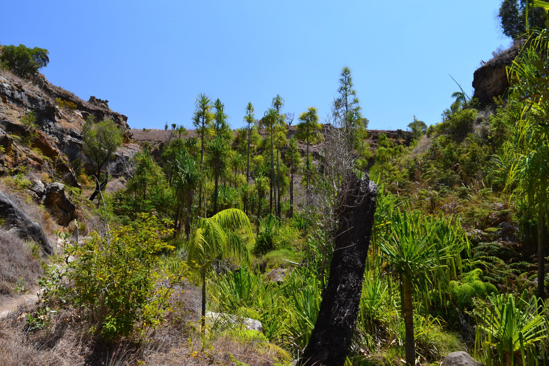
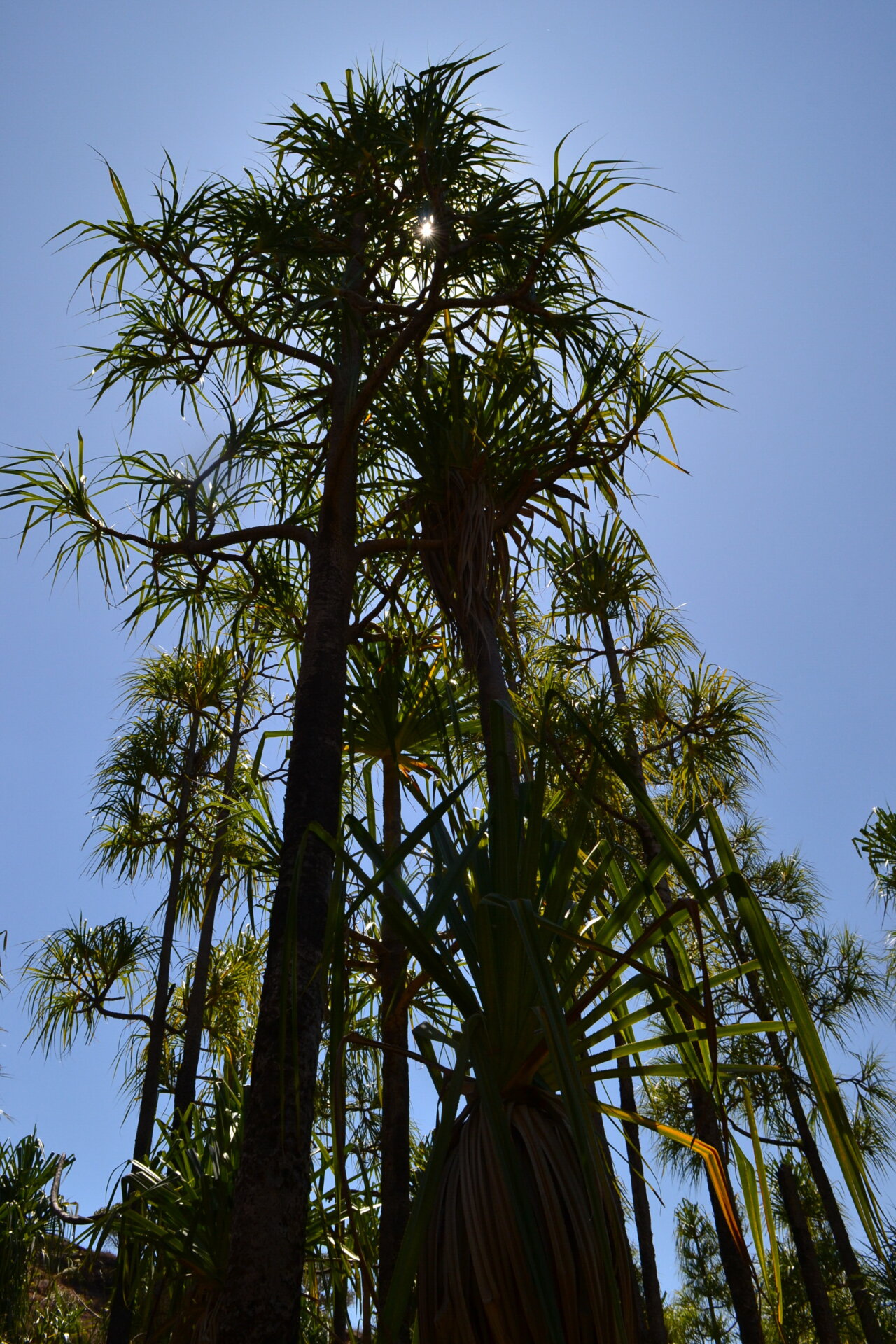
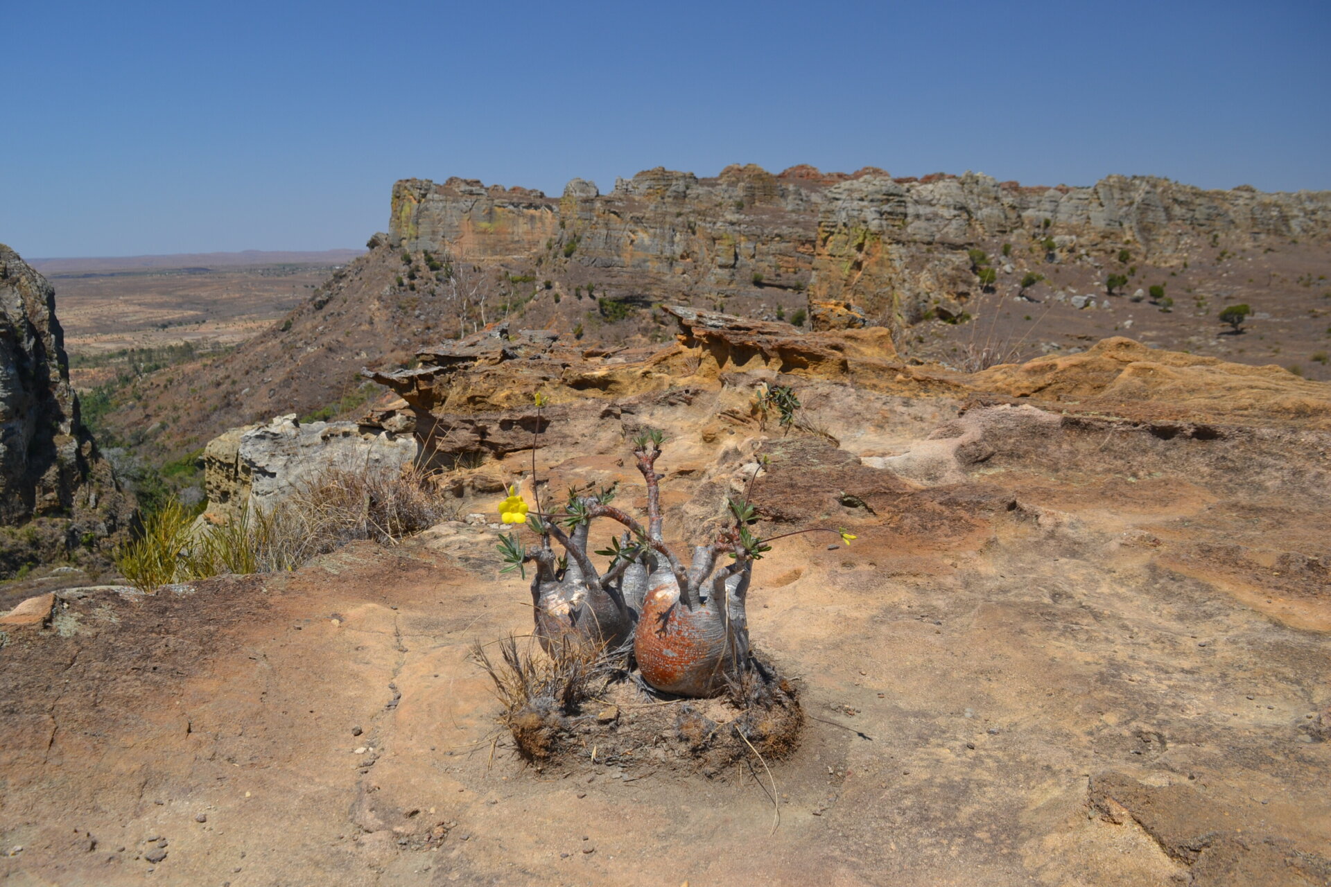
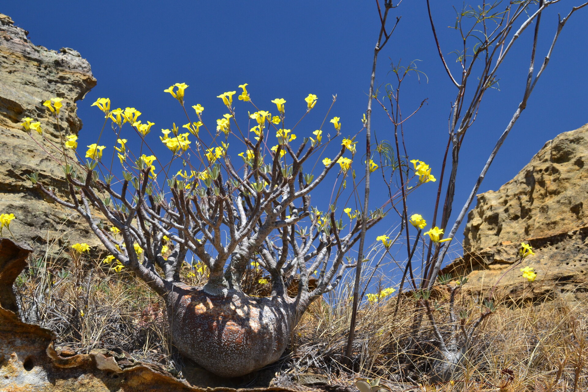
Isalo Park
After the sunny town of Ihosy the road climbs through a mountain range that offers some beautiful glimpses of the landscape, and then descends on the wide plateau where you can try the parks of Isalo, Zombitse and some other minor ones. Ranohira is probably the ideal base for excursions in the Isalo park.

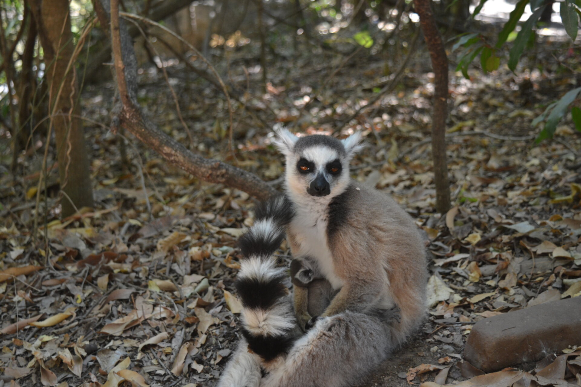
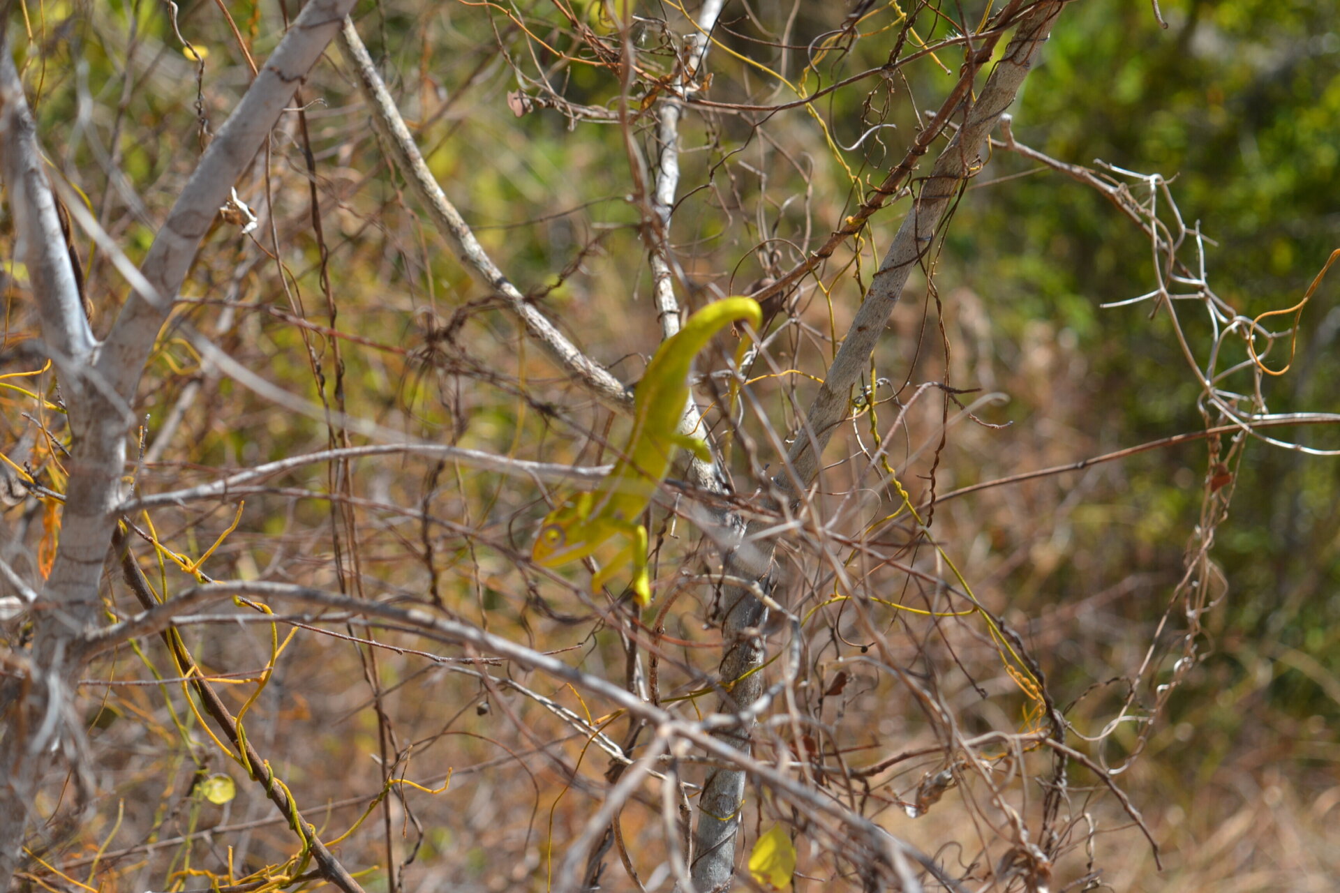
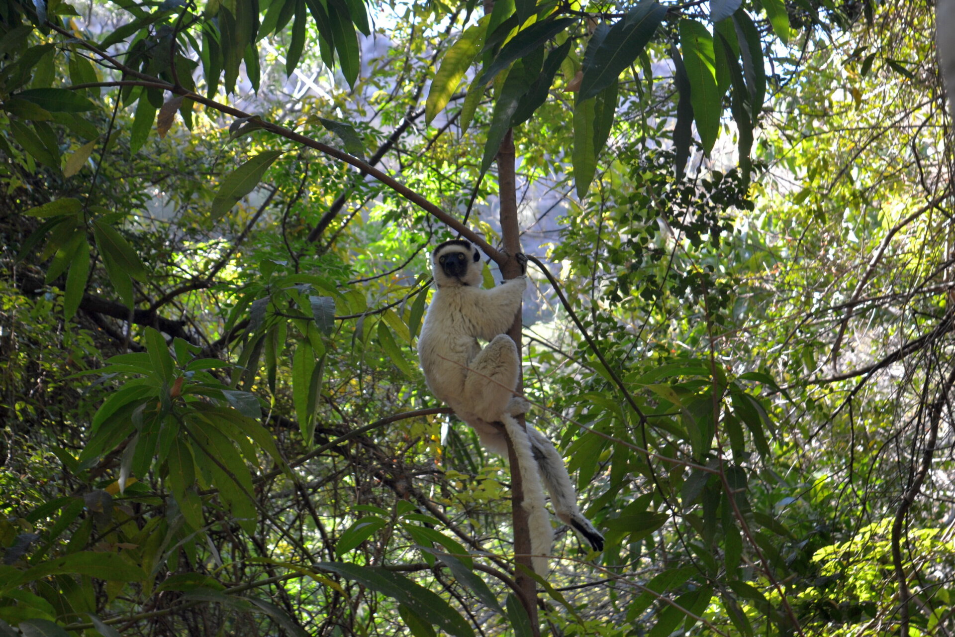
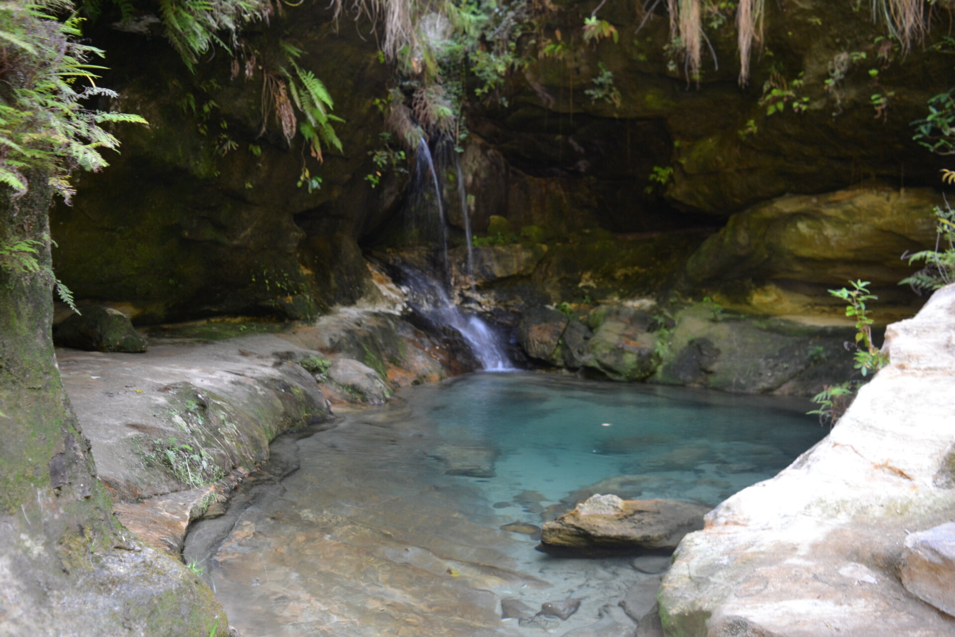
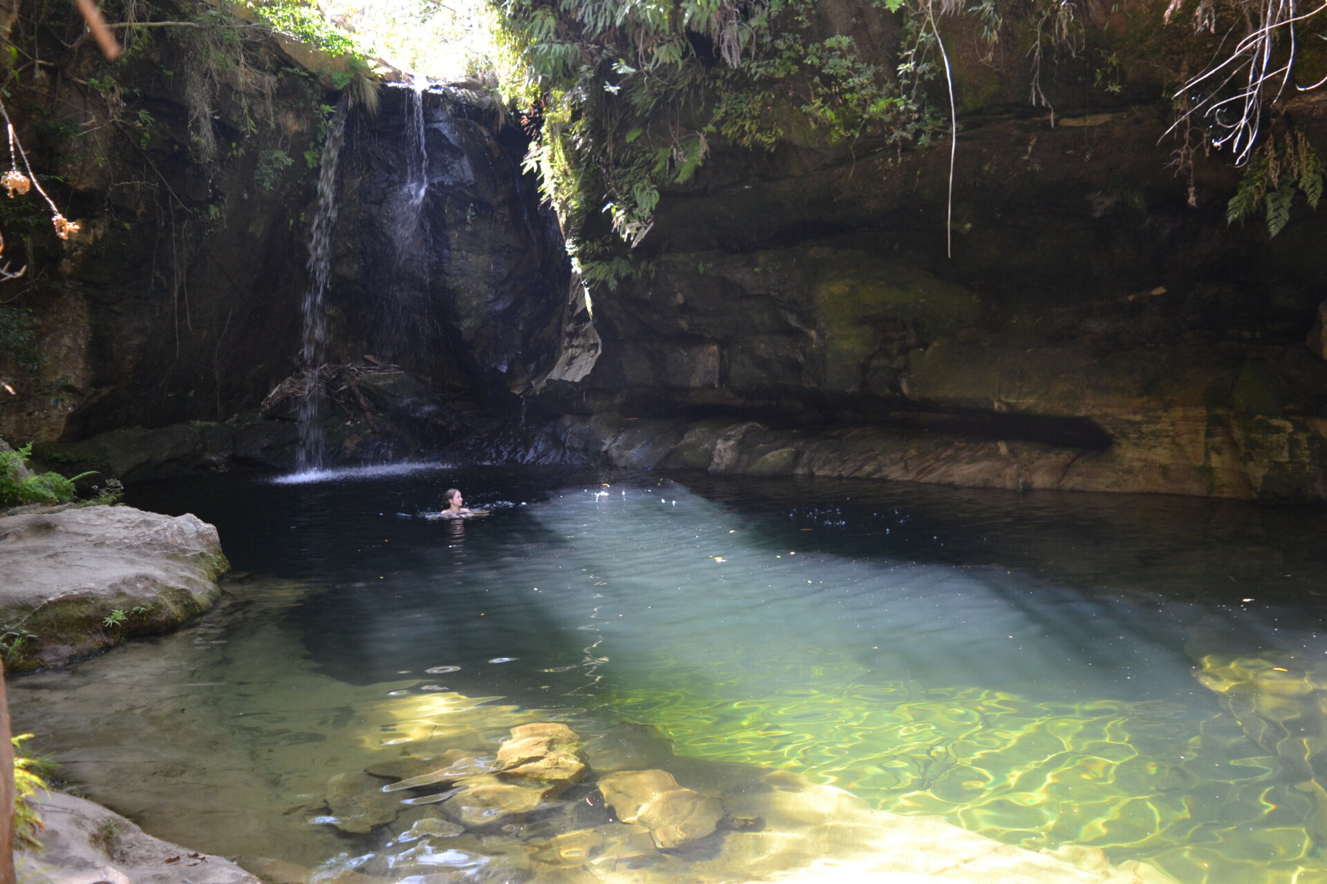
Each hotel is able to put you in contact with one of the many authorized guides with whom to agree on the route of your visit. None of these are particularly difficult but there are many things to see. Starting with the lemurs, some of which, during the day, are stationed near the only small campsite inside the park, eating, playing, arguing quietly just a stone’s throw from visitors. The only day I spent walking around the park was fantastic, a pleasant walk among animals, savannah, forest, canyons and waterfalls.
- All
- Gallery Item


Isalo → Toliara
After Ranohira, the road continues slowly and quietly towards the south. The valleys are getting wider and the climate becomes more and more arid. It happens to climb up sunny and quiet roads and find yourself traveling across a broad land of yellow fields where settlements are rare and it’s easy to travel for several minutes without encountering any vehicle or person. In this area it often happens to pass through characteristic villages whose houses are built entirely of red clay with a golden thatched roof.


Sapphires of Madagascar
On the way to Sakaraha you will notice more and more bizarre showrooms that carry large blue signs: “saphirs”. Near Ilakaka, decades ago numerous deposits of high quality sapphires were discovered. Although now the mines are running out and the extraction has decreased it is always possible to try to buy them in one of the many shops or book a visit to the mines. I remember passing by one, where a man with a large sack was “ventilating” the tunnels below by emptying the sack full of air into a pipe.

The last desert
Before Sakaraha it is not difficult to notice a few baobads here and there along the road. But soon the landscape becomes much more desolate. Although there is very little traffic, the road is again studded with dangerous potholes. The rare villages encountered later are truly miserable, with houses made of mud in a desolate landscape where people are forced to cultivate using the “slash and burn” technique. Throughout the journey, in many areas typical local products are sold along the way: honey, eggs, bananas, straw, drinks… To the north near Antsirabe an endless line of stalls selling toy trucks! Villages in this area sold ropes made of woven straw.

Toliara
Shortly before reaching the coast, the road slowly descends from the plateau. Toliara is a relatively large town and quite lively when compared to the atmosphere of the highlands. My intention was to spend three days relaxing around the far south coast. My hotel was right next to the local “bus station”, basically an absurd bedlam of people, vehicles and rickshaws that invaded the street at all hours. Beyond, although the pedal rickshaws invaded the whole city, there was a fairly tidy and touristy city with some clubs and restaurants (including some very good run by Italians). There was even a supermarket, which I have found very rare in my travels in the third world.

Around Toliara
Inland there is an interesting area called “the thorny forest” which is definitely worth a visit. To the north, on the other hand, I paid a visit to the famous beaches of Ifaty and Mangily, and then quickly returned to one of the mangrove beaches along the way. The beach in Ifaty is nice, parking is paid everywhere (sign of tourism) apparently managed by a random guy without any bagde or other identifying mark. My experience lasted a few minutes: being out of season I was the only European who ventured on a beach entirely populated by locals. In one hundred meters, after all the eyes where upon me, dozens of people came to offer boat trips, barbecues, snorkeling excursions, lobsters, coconuts, necklaces and so on and so forth. The beach at the mangroves was more deserted with only a few fishermen giggling and staring at me for a long time while passing by, probably amazed by the fact a person could use the beach to relax for a couple of hours in the sun.

The tropic line
I read in my guide that south of Toliara there is a fishing village called Anakao, off the main tourist routes and that the opposite island of Nosy Ve is said to have wonderful beaches. Unfortunately, the area is only accessible by boat and the guy at the reception informed me that a trip would cost more than a hundred euros. Anakao lay across a dry river without a bridge and whose only ford had a sinister reputation (later, I would find out it’s so muddy you can get stuck in there). Nonetheless, I decided to check the situation for myself. The road to Anakao passes through a modest village called St. Augustin, famous only for being the landing site of the English two centuries ago. An operation that failed miserably. My attempt to reach Anakao also failed, as the dirt road was so bad that I was forced to drive standing on the pegs. Nevertheless, the Tropic of Capricorn crosses the road at some point and there is a nice monument to delimit the place.

Back to base
As I said, probably one of most uncomfortable aspects of a trip to Madagascar is the impossibility of planning a circular itinerary. At the moment none of the rentals offer the possibility to drop the motorbike in Toliara or any other place. Something that would not be too difficult considering how easy it is to transport the bike on one of the many vans that travel along the RN7. This makes it necessary to travel back along the same road over the last few days. For this, at least three days must be taken into account. It was not particularly annoying for me: a large part of the road is not busy at all and the landscape is very pleasant, so it was definitely worth it!
Thanks Allessio. Great insight and information.
Thank you!
Amazing detailed travel story!
I am thinking of doing the same next month.
Did the rental company asked for your moto driving licence ? I have only one for 125cc.
Also, I supposed you were traveling with a big backpack fixed on the rack? When you wanted d to stop somewhere, where did you leave the bag safe?
Also, I would to a circle circuit, meaning going down the N7 but going back up along the coast to Morondova. Why didn’t you chose doing that? Lack of time or company didn’t allow it?
Thank you very much! To answer your questions, yes, the rental asked to see my driving license, it’s probably a legal requirement for rentals. And to be honest I wouldn’t risk having the bike confiscated by police, so if I was you, I’d go for a 125cc.
Yes, I had a bag tied to the bike with a couple of elastic cables, you clearly see that in the cover picture. I use vacuum bags to keep my luggage small. I wouldn’t say Madagascar is a dangerous place but there’s a lot of poverty and beggars around so you don’t want to leave that on the bike. If you visit parks it’s easy to leave your luggage somewhere. Otherwise the best thing is probably to travel from hotel to hotel, then going for visits after you left things in your room.
Yeah, a circular route is always the best thing to plan, if possible. But believe me it’s not an easy thing to do in Madagascar. I had two weeks only and it was just enough to get to Toliara and go back. Moreover, while on the east side there is a minor road that travels along the coast, there’s no such thing on the west coast. You can ride along the RN9 that will take you back to the interior, but I’m sure it’s a bad, unpaved road and you will just find poor villages along the way, with no hotels and support should something happen. Plus, there’s no bridge crossing the river close to Tanambao (have a look at Google street view). Apart from that it’s just a matter of time and energy 🙂 Ask the guy you will rent the bike from, he will give you the best advice.
Good luck!
An inspiring trip. Did you travel solo? It would be nice to hear your thoughts on personal safety in Mada.
Thank you! Yes it was a solo trip. I would say that Madagascar can be considered a safe place, at least compared to many other African countries. Of course annoying vendors, beggars and petty crime are everywhere, so be more careful in larger towns like Tana, Toliara or Fianarantsoa. A widespread phenomenon are begging children along the RN7: just stop to take a couple of photos and you’ll be surrounded by a swarm of begging kids. Police is generally very tolerant with tourists: you will most likely pass through many checkpoints along the RN7 without a problem. Driving is also not very difficult, especially if you have experience of driving in other African countries or in Southeast Asia: potholes and trucks to overtake are the main threat.