
An amazing day journey
When you think about Patagonia it’s hard to focus on the whole region. Some people tend to identify the whole thing with Ushuaia or the parks in the very south. When I finally left Coyhaique and was heading down to the big, unknown General Carrera lake I was thinking I was probably halfway to my destination. I was trying to stick to my plans but started suspecting times and the miles ahead were not exactly on my side. Especially considering my plan included a visit to Perito Moreno glacier, the Fitz Roy and Torres del Paine parks and the Marble Cathedral by the lake short ahead.

Getting to Ushuaia had been sadly removed from my plans thanks to the great Latam performance with my luggage. Even Punta Arenas, its cliffs and penguins seemed hardly reachable. I was two or three days short for all of that. In addition, I was advised not to go all the way down to the end of continent: according to the rental man the journey would have been a long, boring one on a flat and windy pampa land. A psychological goal more than anything else.

In order not to miss also the remaining destinations I tried to speed up. The idea of staying at Bahia Murta and taking a ferry to cross the lake was replaced by a long haul to Los Antiguos, mainly because the ferry was leaving late, once a day. Los Antinuos was a village just across the border that divided the large General Carrera lake in between the two countries.
Though chilly, the morning was beautiful and sunny
My hands were numb and I had some doubts about the planned road. Ulli warned me that this would be the most difficult part of the journey, with a long dirt road and strong wind blowing on the shores of the lake.
In the middle of the morning, on the umpteenth stretch of dirt road, I stopped to dust myself at a little house lost in the forest that was also a B&B. There was a motorboat parked in front but no guests. I had a coffee and started a conversation with two nice elderly people, so curious about my trip and willing to help with choosing the best route: I wasn’t sure of being able to reach Argentina in one day and there seemed to be a ferry from Puerto Sanchez to Chile Chico, cutting across the lake therefore saving about 200km of probably dirt and windy road. Unfortunately, it ran only once a day, early in the morning.
I warmly said goodbye to those exquisite people, who even bought me coffee and set off at full speed towards the lake: I would have stopped in Puerto Rio Tranquilo and decided what to do.
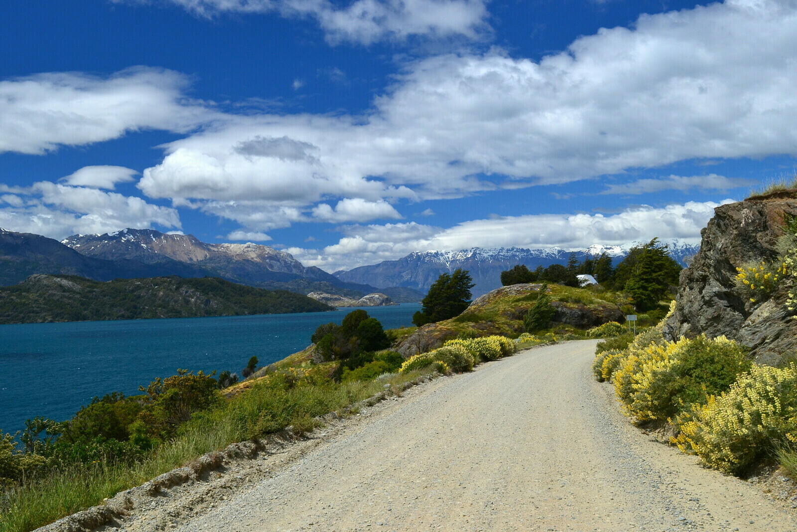
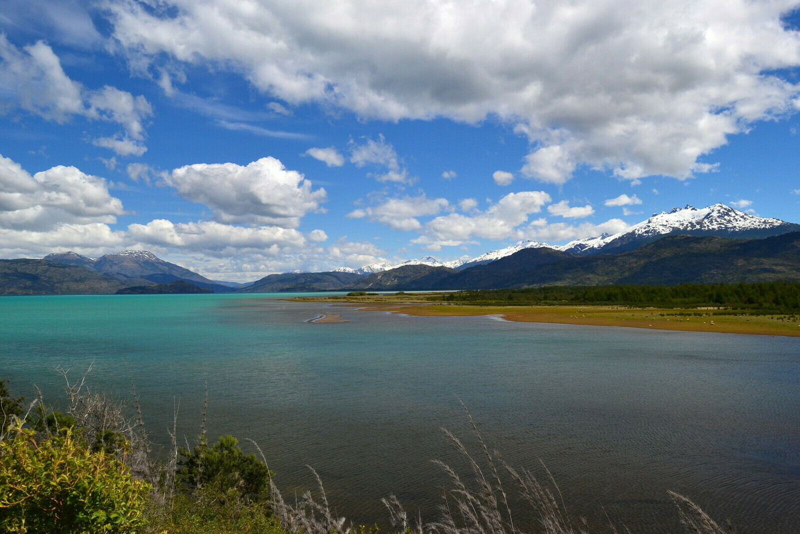
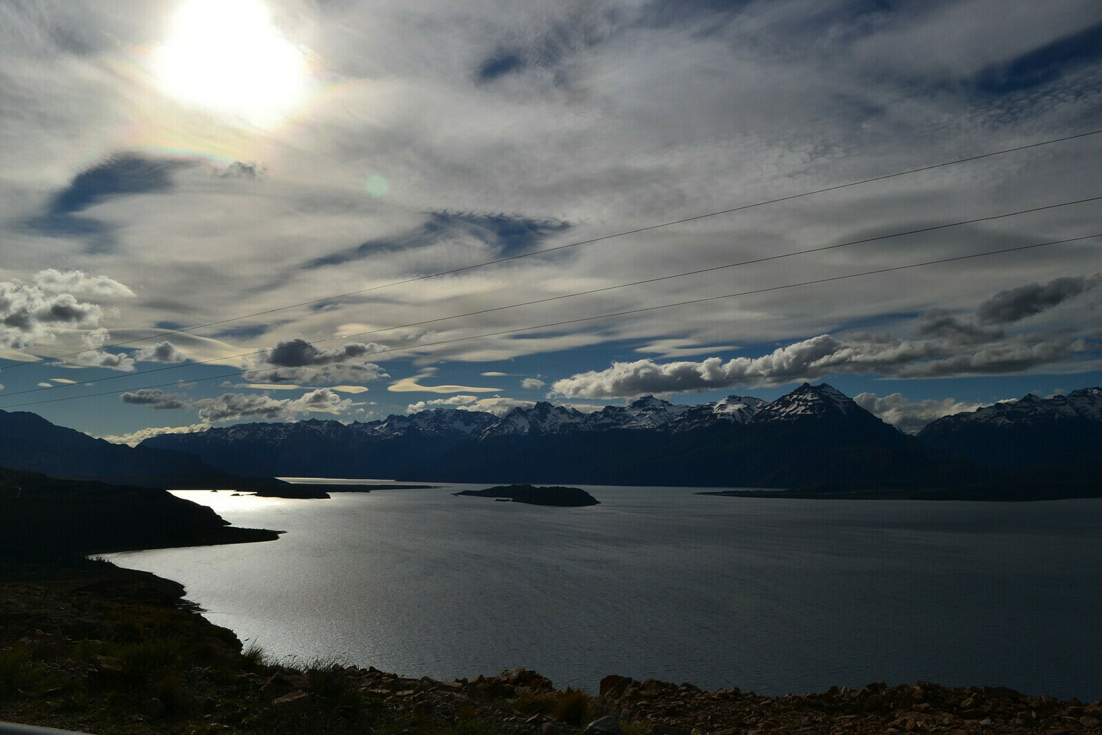
The world's most wonderful lake
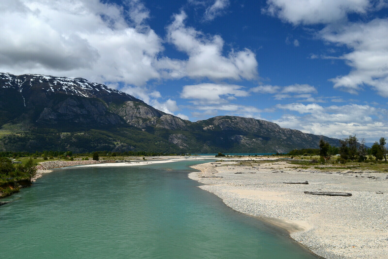
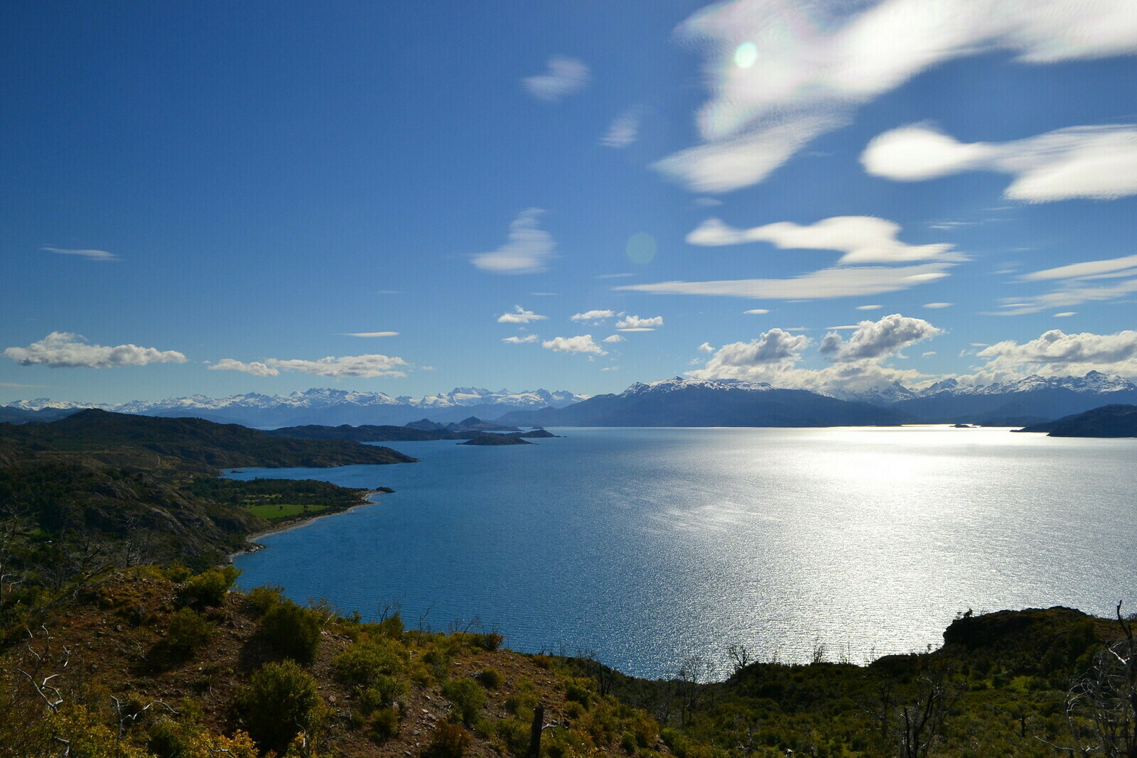
The road that came out of the mountains and led to the lake was breathtaking. The colors of the lake and the mountains that surrounded it were so incredible I did nothing but stopping and taking pictures. And none of them have been filtered. Contemplating the amazing landscape I was once again surprised the area seemed basically uninhabited.

After a stretch of sunny and pleasant road, I arrived in Puerto Rio Tranquilo in the early afternoon: a handful of small houses. So few I doubted it was a real village: a couple of bars and several shacks lined up on the beach that all sold excursions to the caves. I was starting to get tired, it was already lunchtime and the 200km of dirt road in front of me didn’t promise anything good. Las Catedrales de Marbol were right there but I reluctantly had to abandon the idea of a boat excursion to the caves. I asked about the road, I had another coffee and I left with some doubts about being able to reach Argentina before the border closed.

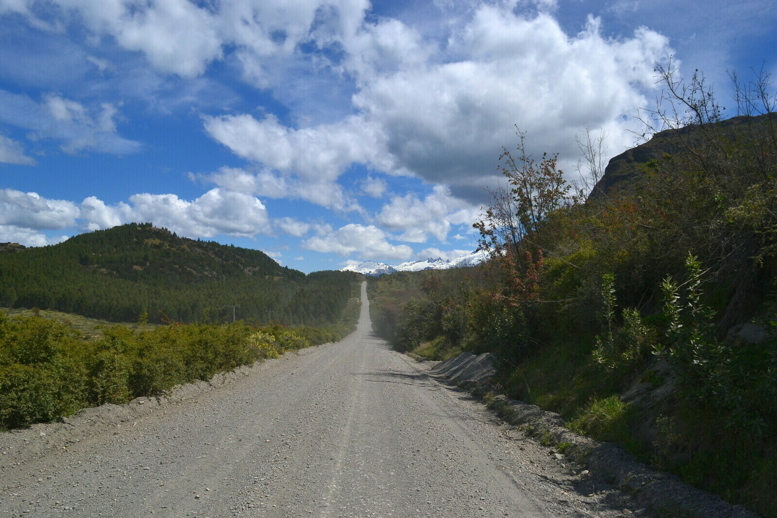
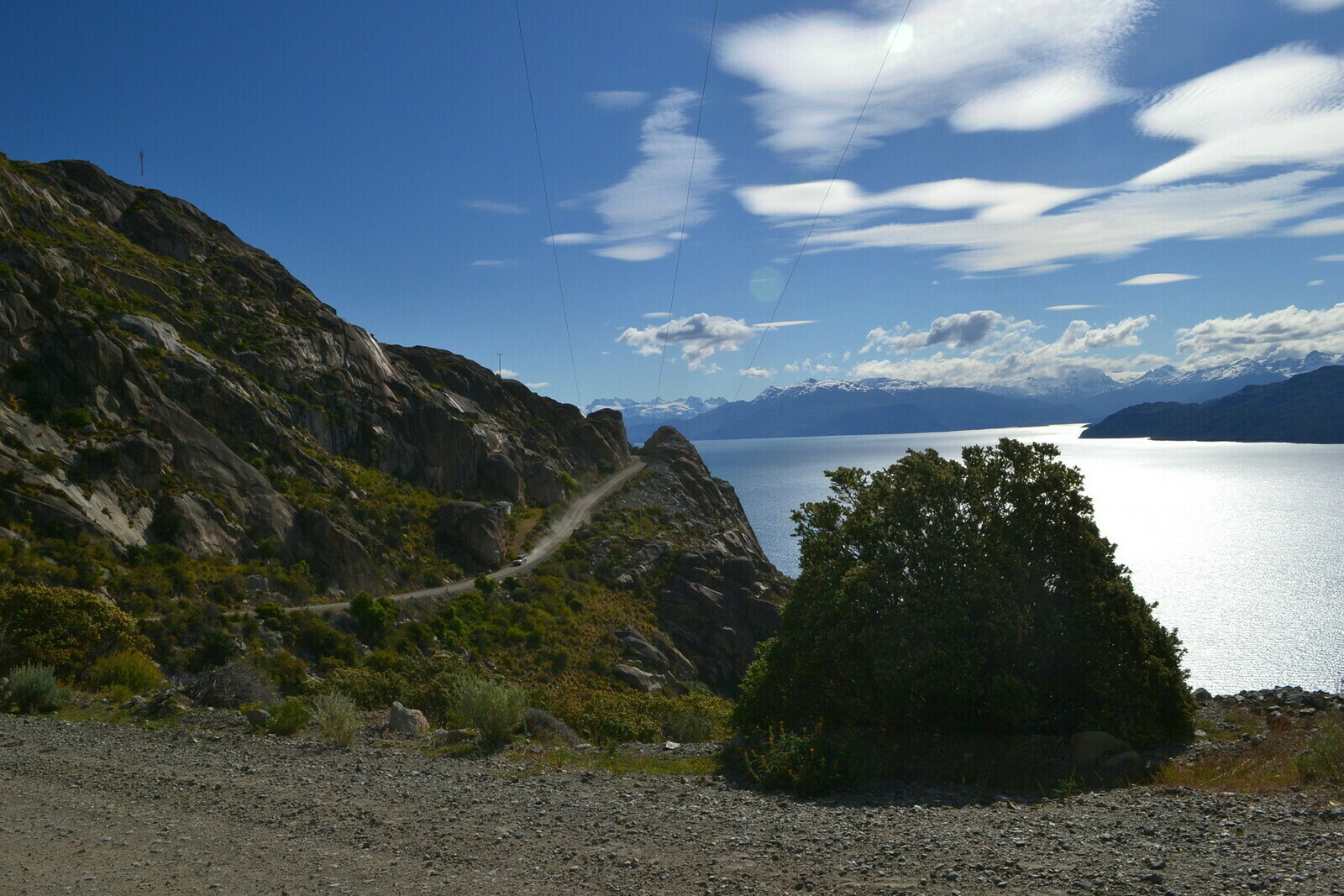
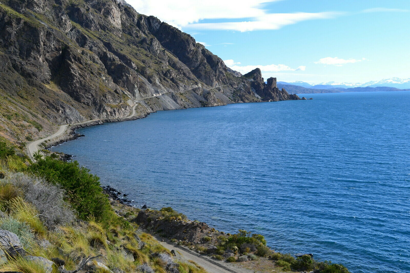
In spite of everything, I couldn’t resist stopping for taking few more pictures of the lake. The road after Puerto Rio Tranquilo was all unpaved and at times full of potholes and stones but no gust of wind. And the landscape was literally stunning.
Before a village called Puerto Guadal the road reached an anonymous crossroad. Continuing along would mean heading towards Cochrane and down to a misterious place called O’Higgins where the Carretera Austral was coming to a dead end. I lost contact with the Italian guy I met the previous day, we were anyway to go different directions: he was planning to continue along that road down south. It was the wildest and most remote part of Aysen, the Chilean Patagonia. I have to say on the previous day I had even considered the idea of doing the same and crossing the border from O’Higgins: from the map it seemed like there was a small border crossing. A couple of Chilean Carabineros had confirmed the information. Chile has a police force called Carabinieri, dressed in green: I came across them on the way to a cafeteria, they were so kind and willing to help. Plus they had been asking things about my trip and my motorcycle. To make it short, I wrote Ulli telling him of my idea of crossing at O’Higgins and he immediately stopped me. The border was there but it was on a mule track open only a few months a year and used only by trekkers. Absolutely impassable for a motorcycle.
So, having no more doubts about my path I headed east to Los Antiguos as planned while Alessandro – that was the Italian guy’s name – having more time at his disposal was heading straight into the south. He later would have sent me a few pictures: apparently a village, Caleta Tortel, is made of stilt-houses!

Late in the afternoon I kept on breaking what I thought was my speed limit on such roads. Fatigue and concern for not being able to reach the border on time made me take some risks on a road that was no longer just dirt but sometimes stone-covered with no protections.
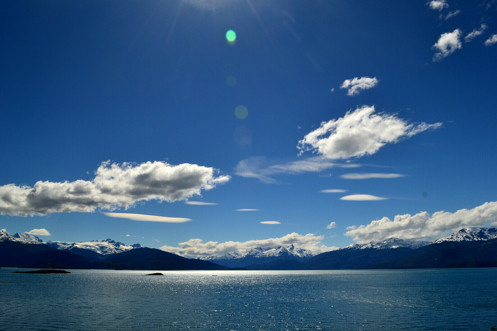
Despite the difficulty, the road was incredibly fascinating: maybe the most beautiful stretch of all my journey.

With all the necessary luck, I reached the end of the road that was circling around the lake, then out of the mountains straight towards the other half of it, in Argentina. With enormous relief, after a final bend lied the frontier hut. It was 7.40 pm (the border closed at 8.00 pm), I was quite tired but very happy. The hostel I booked was just a few minutes from there, before Los Antiguos.
Goodbye Chile, Los Antiguos
The land had become all of sudden flat with distant horizons, as soon as I passed the border. My plan of going around the lake in one day was successful. It worked even better because the hostel I booked was very pleasant and the owners were very kind. If you pass by, write down this name: Hospedaje Posada Pesca Aike. The owner, Rodrigo, who is a fisherman and his wife are wonderful people and they will not make you miss anything. When I got there, the hostel was almost empty and so was the village of Los Antiguos, as I would discover the nex day. Rodrigo’s wife brought me some fried cutlets and a salad, I got myself a beer and I spent the evening chatting with him.

I have to say it was very pleasant to conversate with Rodrigo at the end of such a day. I started gathering information about the next stage of my journey. A long stretch of the so called “Pampa Argentina” was lying ahoead of me before I finally made to the south and the most known national parks. Desert, wind, dust and a long sunny road that could turn into dirt and mud all of a sudden was to be expected. The thing that worried me the most however, was gas stations. Somebody told me they were sparse and with no guarantee of finding them operational. A i learned afterwards one was in Bajo Caracoles and another in Gobernador Gregores. Not much. I had my portable gas bag with me for which I was very grateful.
The man also warned me against the presence of animals on the road. If you think of a desert you generally think of something… well, desert. In fact, considering the low presence of humans some deserts are quite populated with animals. Rodrigo recommended to pay special attention to one kind in particular: the guanacos! Honestly, I had no idea what a “guanaco” was. I tried to get an explanation but all he said was that they were “como caballos”, like horses. What kind animals were they? Apart from some kind of prehistoric giraffe, nothing came to mind.
They are basically like llamas, they inhabite the desert plains rather than the mountains. You often come across small groups of them, apparently minding their business at the edge of the road. Or right in the middle. And even worse, as you approach they might decide that the safest place to escape to is right across the road.

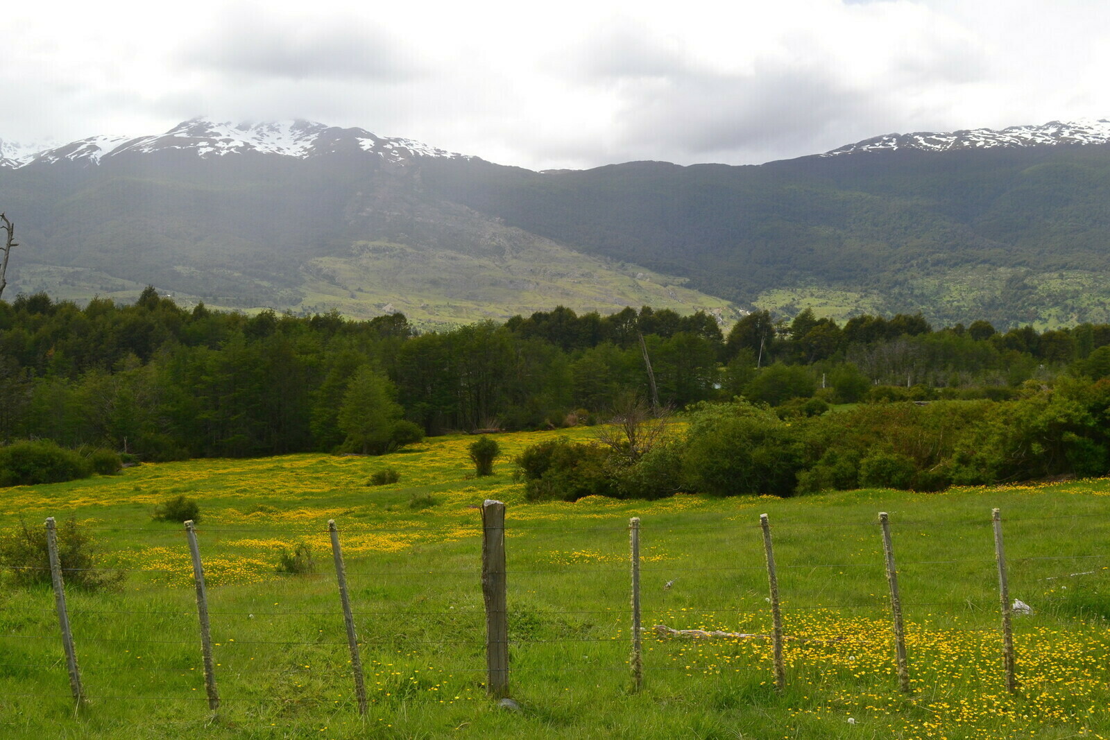
The following morning before leaving, I decided to have a look at the village of Los Antiguos and take a small tour on the lakeside. The village somehow resembled some sea resorts of my region, more than what I tought a lake village could look.
The landscape had completely changed and the lake no longer had the alpine atmosphere of its other half where I came from, but it was equally beautiful. The beach was cute and strangely deserted.
As I would find out later, besides the guanaco packs you could find a variety of other animals in those lands: coyotes, ostriches, desert hares: they crossed the road as I was passing so many times. And once I got to a place where the asphalt was dotted with thousands of black spots: a whole swarm of grasshoppers was lying on the road for hundreds of meters!


Pampa and clouds
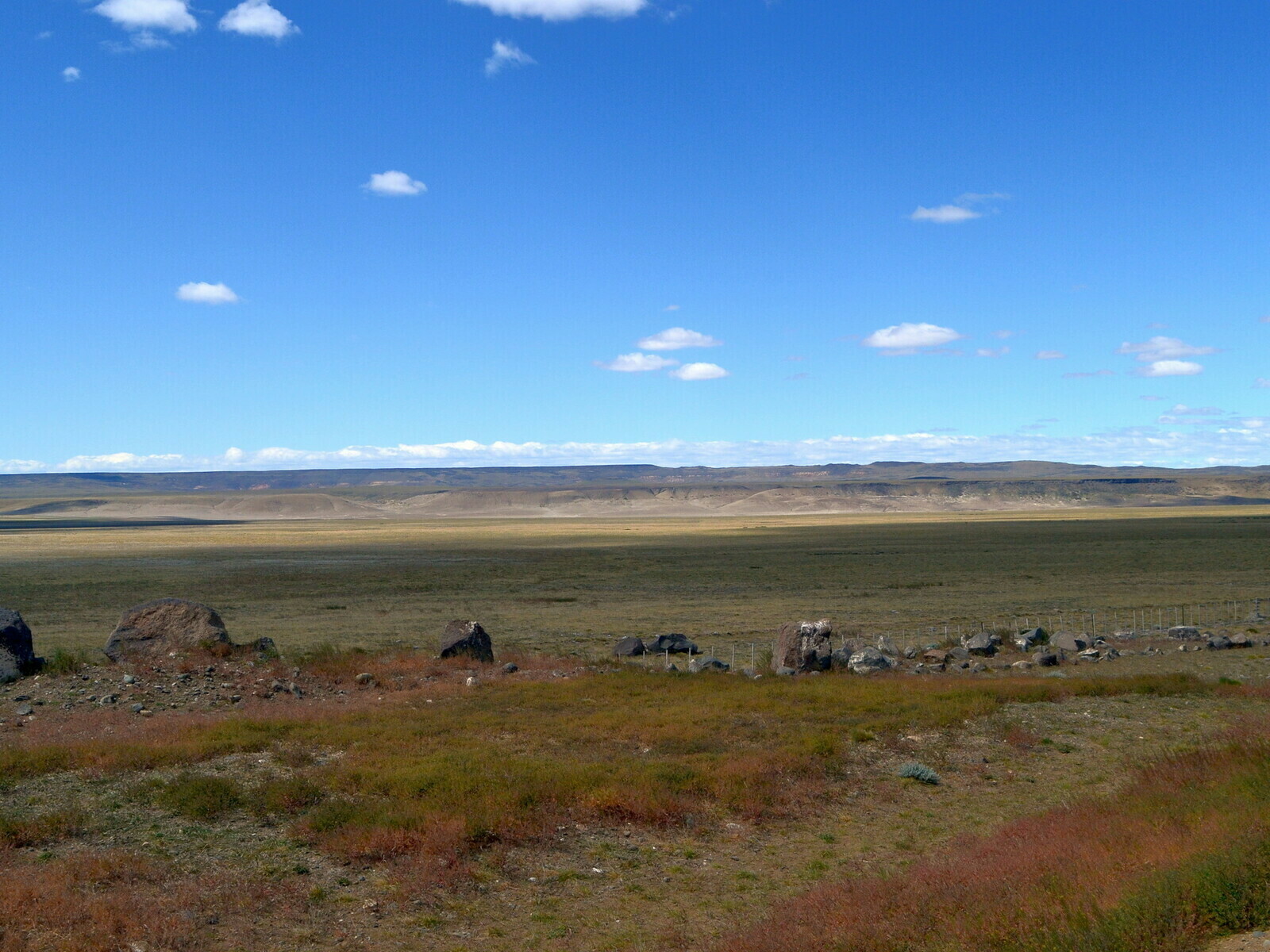
Despite how creepy or dangerous it could be, I have to say it felt really nice to come across so many animals during the trip down south. It was amazing how quickly the landscape had changed coming to Argentina. From a scenario of mountains, lakes and forests I got into a desert land similar to those you see in western movies.

Very few humans inhabit those lands, towns were very far apart with nothing in between. From time to time I was crossing with trucks and drivers where honking and waving their hands saying hello. I mean, things like these make you feel good. In fact, the journey was beautiful and very relaxed: sun and a mostly paved straight road
Bajo Caracoles, where I fueled for the first time was a handful of rather shabby houses, an emporium and a post-war petrol pump. A sign on the road was telling the story of the Polish pioneer (or was he Czechoslovakian?) who founded the village for some unknown reason. The woman at the emporium seemed utterly bored and was apparently drowning boredom in her mobile phone, paying little to no attention to me.

The desert had a unique charm. Every now and then we met immense farms (Estancias) in the middle of nowhere, the only green and cultivated oases in the neighborhood, stretches of pink desert. The sky was immense and the mountains now far away on the horizon.
Except animals and a few annying traits of unpaved road full of grooves, the day pleasantly ended. I passed by a handful of “estancias”, like raches, that looked like oases in the desert. Before dinner time I got to a small town callled Gobernador Gregores. A quite pleasant town, considering how remote the region was, provided with everything, a bank, a supermarket, a gas station and a few modest restaurants.
The village was displocating on the side of a long avanue, with not much around. I had a conversation with some local boys who were amazed by my motorcycle and were curious about my trip, before directing to my bnb. That was a bit out of the main road (I mean, a few meters) in a place with few modest houses where dogs’ favorite hobby seemed to be getting mad at me and throwing themselves after my bike as if they were possessed. Fortunately, after dragging all the dogs of the neighborhood out of their houses I finally made it back to the village for a very rewarding part of the day: looking for a restaurant.
Rolling southwards
El Chalten and the Fitz Roy
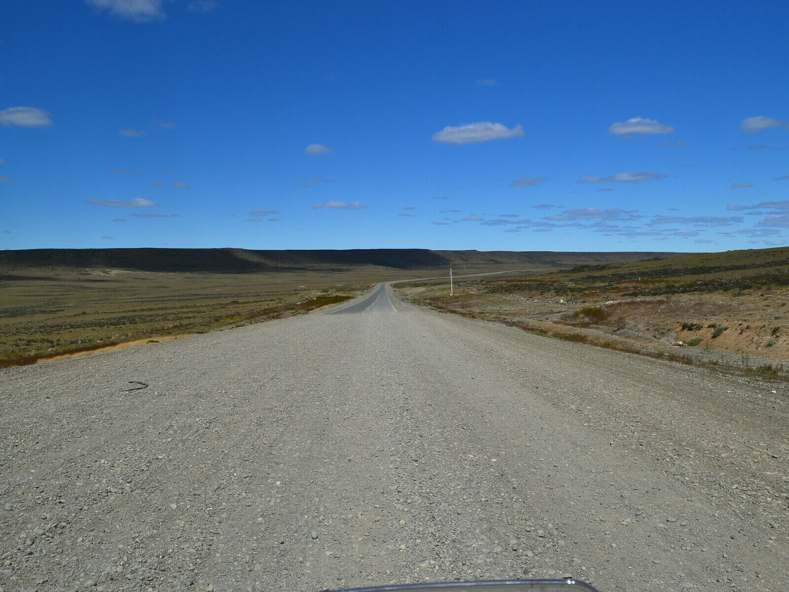
People told me and I read it many times: Patagonia during the warm season from December till March was tormented by strong winds. I don’t know if I had been lucky, but I was spared until that day. Unfortunately, it was something I was destined to face after leaving Gobernador Gregores. The road was mostly straight and rather boring but an annoying western wind made soon its appearance. I was fierce and it was constantly forcing me to correct my trajectory and to travel with the bike tilted to the right as if I was about to turn on a straight road. Believe me, on a road going south through the plains that wind was a plague.

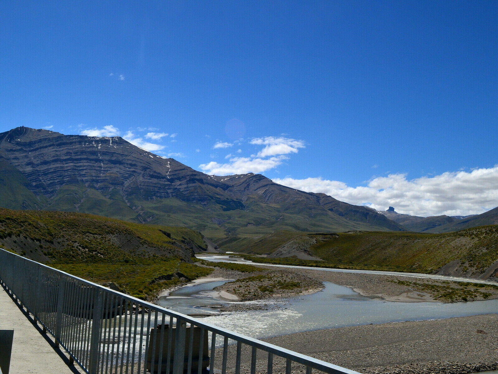
At some point after Gobernador Gregores there was a stretch of dirt road Ulli had warned me against: in case of rain it would be impassable. Something like you had to go back or go on a long circle in order to drive around it, hoping gasoline would be enough. Fortunately it didn’t rain and after the umpteenth dusty and windswept stretch I arrived at Lake Viedma, entrance to the Fitz Roy National Park.

Taking this picture of me was a nice Argentine family doing the same thing everyone does in front of that sign. In particular, the grandpa was a bizarre type: I think I heard more swear words and curses in Spanish in two minutes than in years. Actually, he was a very nice person, we talked a bit and in the end he told me, with a solemn expression, that in 70 years never saw the Fitz Roy not covered by clouds, not even once. Lucky me!
I stopped for a few more minutes to contemplate the wonderful view, thinking that after having my luggage dalayed everything went really great. Luck is blind, so when things go well you just have to enjoy the moment and be grateful.
I was told that El Chalten was a place that deserved more than a quick stop. A few kilometers after the sign it was lying at the feet of the mighty mountain and its park: it was a lovely village with two parallel streets and a myriad of hostels, restaurants and pubs, to the point that there seemed to be no building that didn’t belong to one of these categories.
The atmosphere of the place was really vibrant, youthful and peaceful. The largest part of visitors was composed by hikers and nature lovers and had nothing to do with the messy noise typical of most tourist places.

Being afternoon, regardless of being tired I left the luggage at the hostel, grabbed a park map and ran up one of the paths leading to the base of the mountain, eager to take advantage of the spledid day.
I arrived at the first level before giving up at the edge of the Laguna del Pato pond. The next day I would have tried again. I was enough for the day, just time to enjoy the evening in a place that served grilled meat and an amazing craft beer.

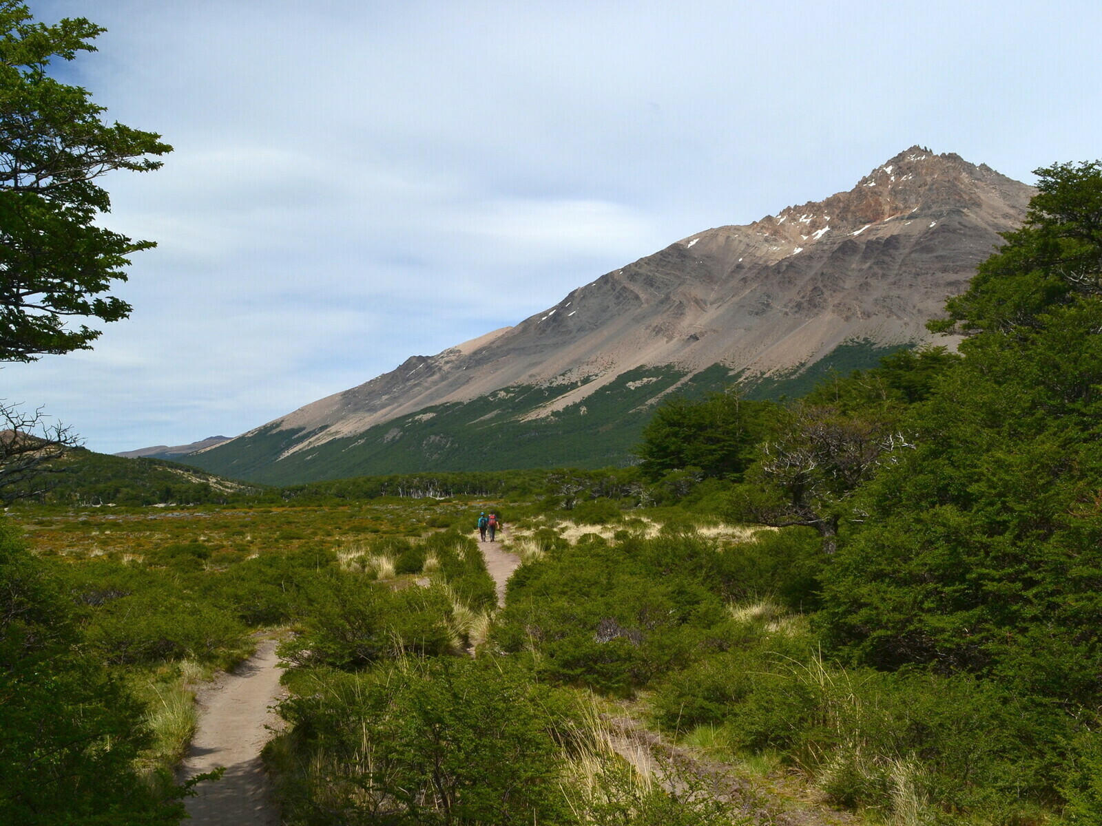
Next morning I decided to climb from a side valley, the Piedras Blancas path if I’m not mistaken, with the intention of tackling an alternative and more scenic route: a rather long but quiet climb through a beautiful forest. At the top of the valley I came to a flat area and a crossroads of various paths. A camping place was hidden beneath the branches of the trees of a grove right next to the crossroads.

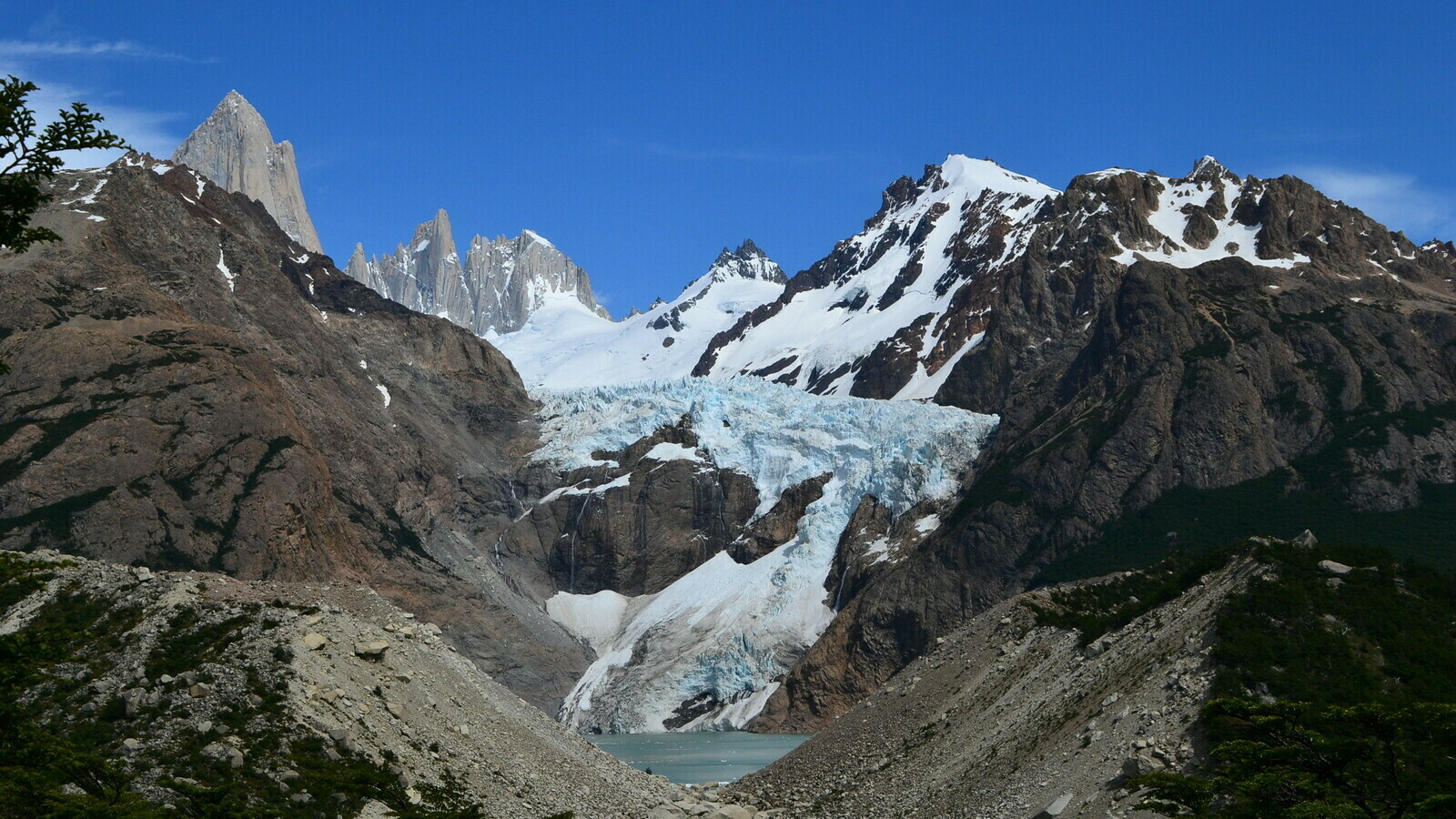
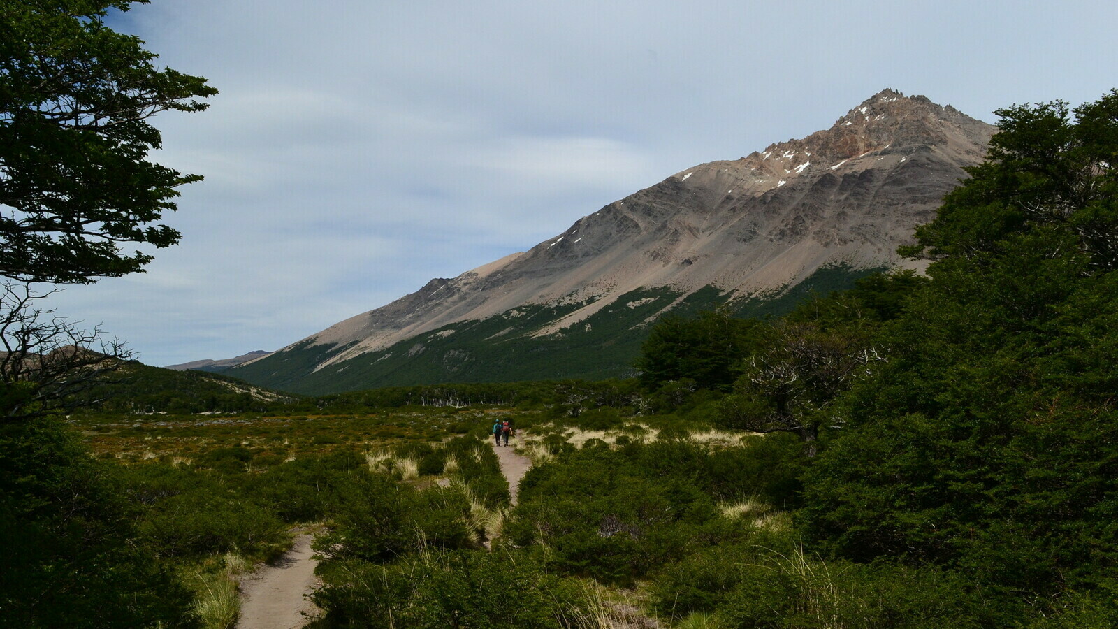
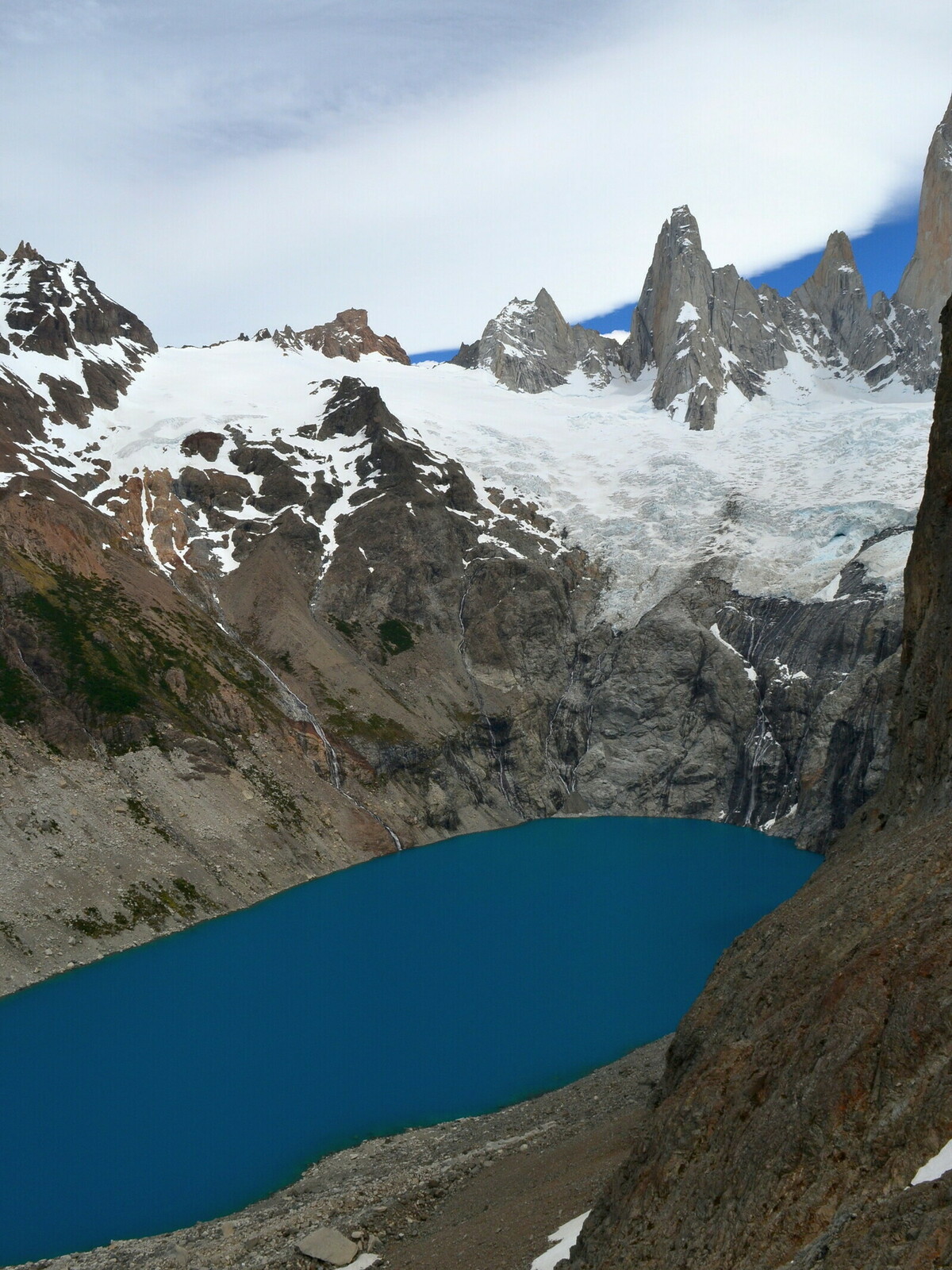
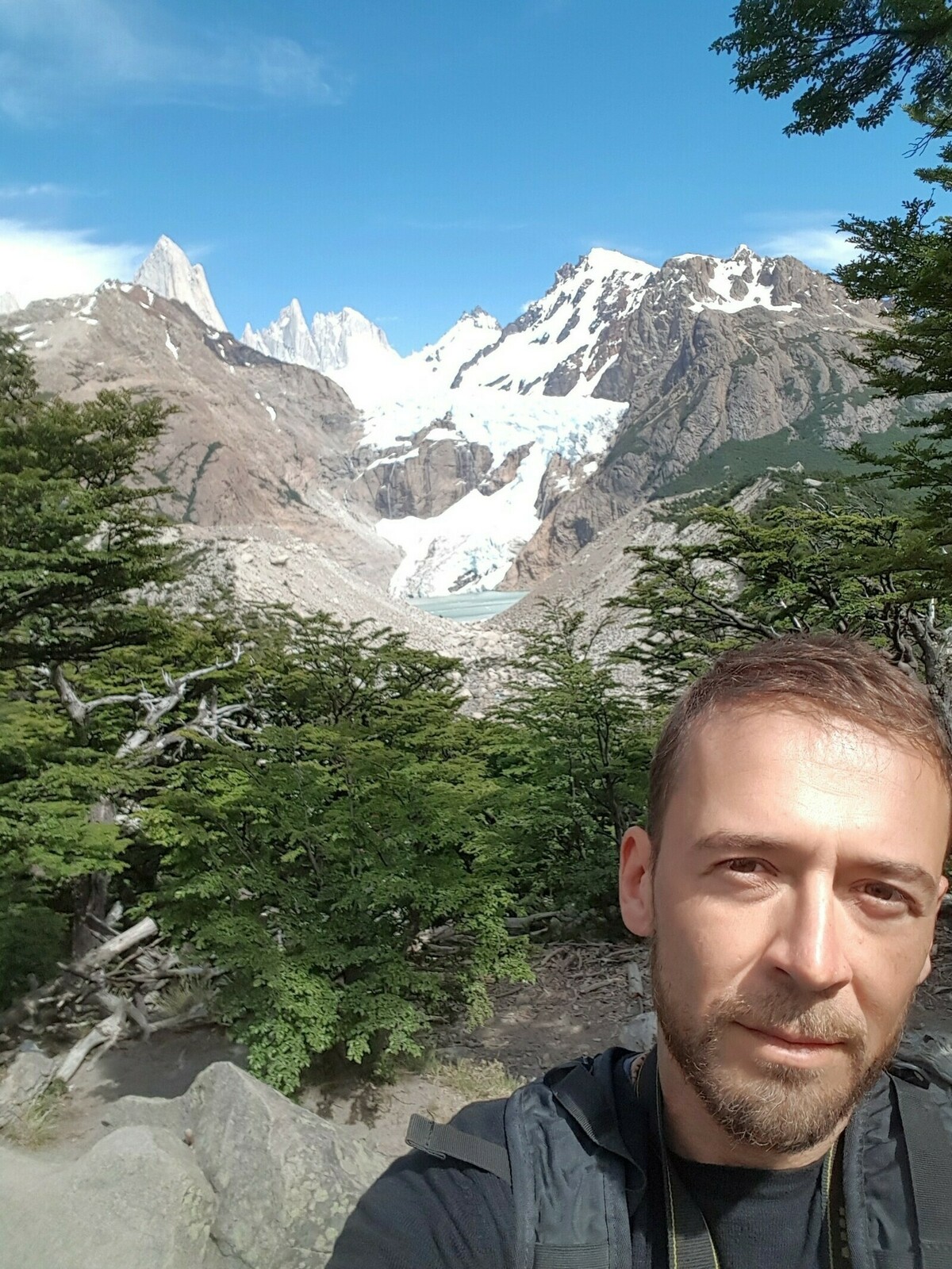
The camping area with the strange name of Poincenot was not an equipped one and a handful of colored tents were scattered among the trees. After the trees, a stream where some boys were filling pots and water bottles. After that began a deadly, vertical climb of maybe one kilometer that led to the lake at the base of the Fitz Roy. A procession of hikers unraveled on steep path that climbed up the stairway made of stones and bushes. I never faced a climb worse than that. It was funny to look at the faces of those coming down or going up, trying to guess if the climb was worth or if the end was near. After one hour that never seemed to end… victory!


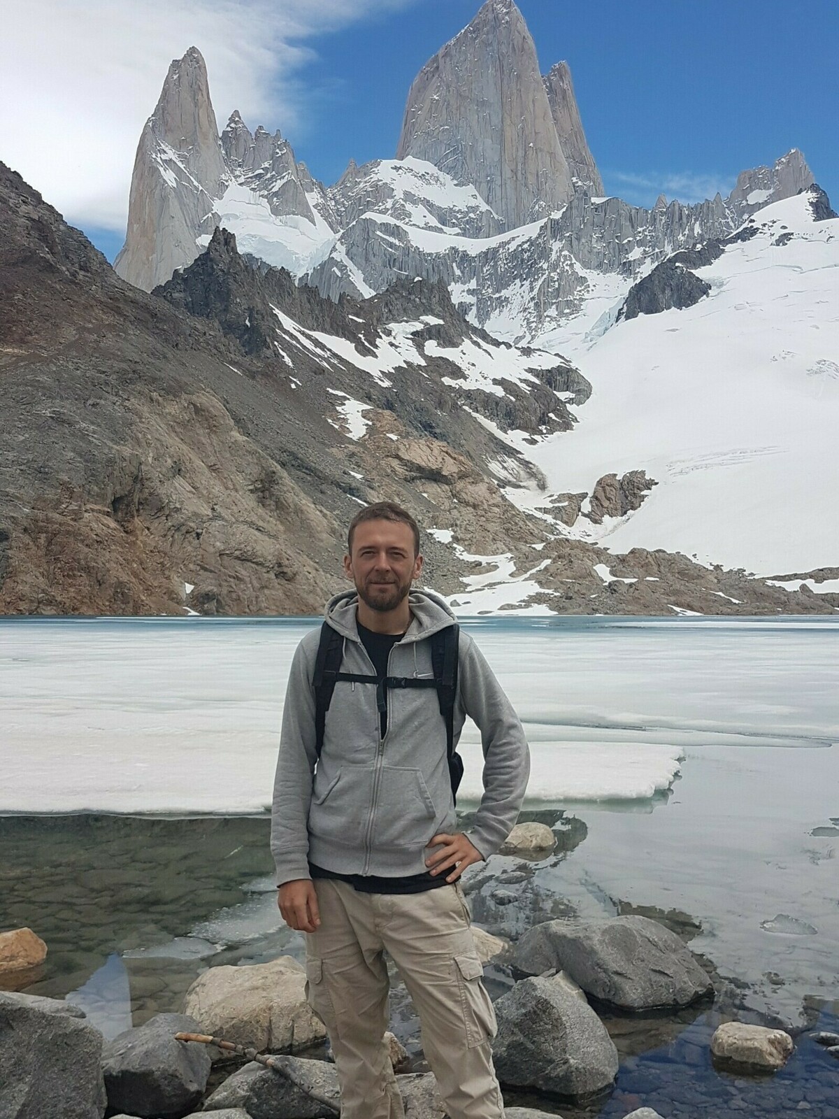
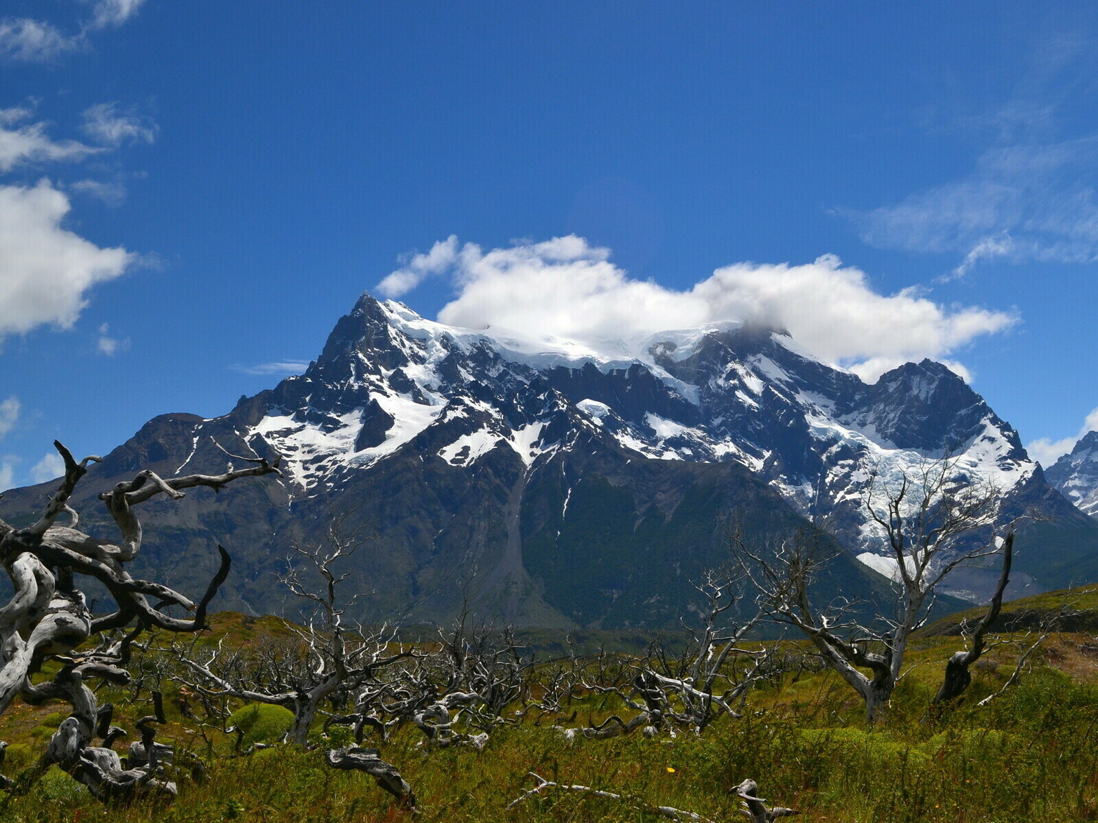
The base of the Fitz Roy was a stone terrace with a lake as blue as the sky. On the left, a deep basin with another oval lake into which some streams were diving headlong through vertical walls. In front of the three towers of the Fitz Roy, immense, indescribable.
Two days later, I have to say I left reluctantly. But what comforted me was the thought of the next two stages: the Perito Moreno glacier and an even larger park, the Torres del Paine.
Fifty shades of blue, Perito Moreno
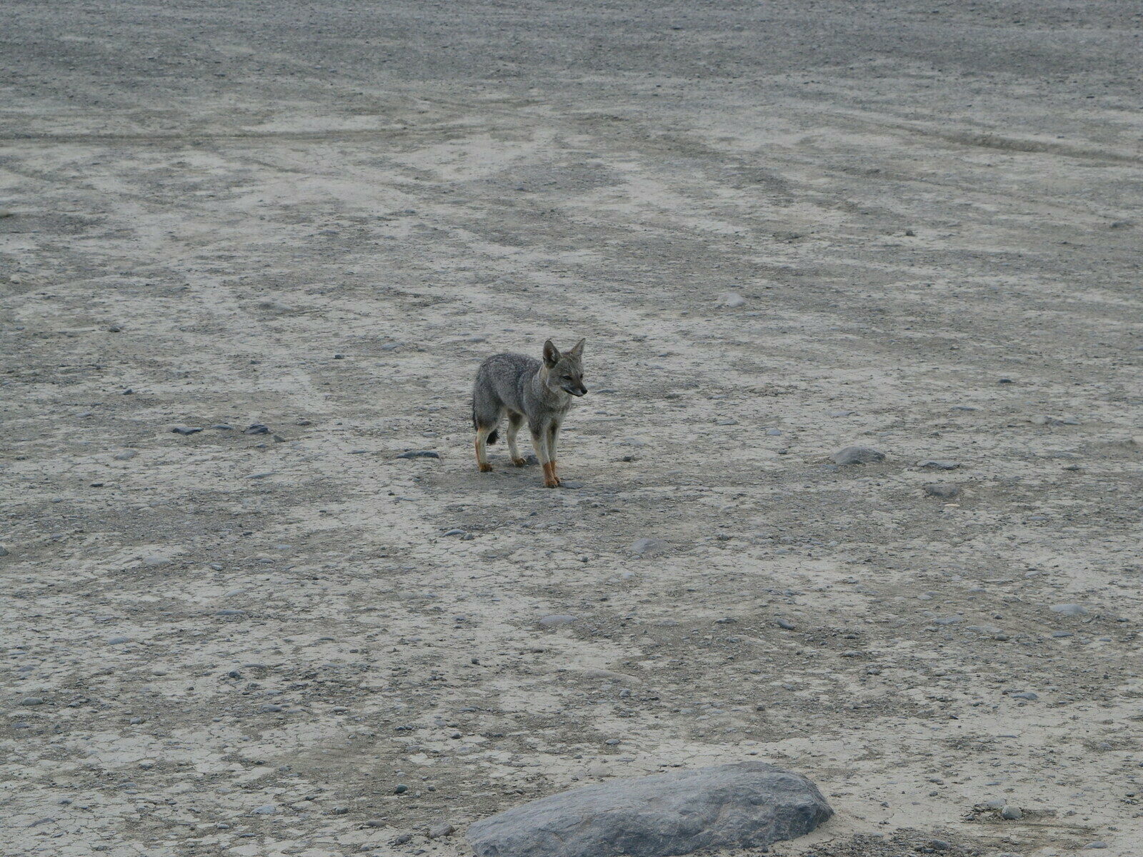
The journey to the south continued with no ups or downs, just the amazing scanarios of the landscape and a meetings you wouldn’t expect: a coyote of the same color of the ground and yellow feet legs that wandered over a rest area, incredibly at ease with my presence and with whom I shared my sandwich.

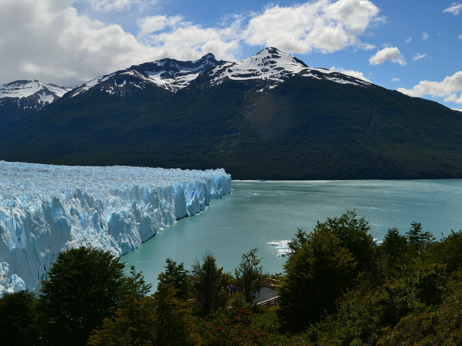
I had only a few days left to complete my journey. The next stop was the famous Perito Moreno. After siding a lake under a sky striped with white and grey clouds, at the bottom of the valley a white mass loomed motionless seeming to slide slowly down into the lake below.
The bright day was probably part of it but the visit to Perito Moreno was one of the most fascinating moments of the entire vacation.

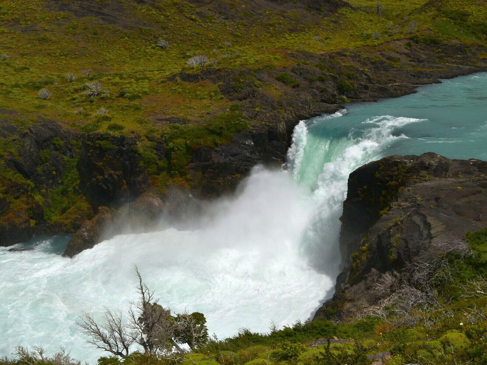
A ferry can take you across the blue lake right at the foot of the glacier front but apart from that, you can visit the glacier through a nice, elevated walkway that runs though the forest, above the treetops, right in front of the glacier and grants incredible views.
I spent the day walking up and down the various paths across the woods where you could find terraces and benches.
Every now and then, a block of ice broke off from the head of the glacier: you could hear a dull thud, followed by shouts of surprise. Turning around quickly enough you could barely see the rippling surface of the water and a few pieces of ice rolling down. The glacier seemed close but it wasn’t: when the noise reached your ears the whole thing had already happened. That’s the reason why on some terraces photographers armed with cameras big as artillery pieces were waiting, motionless, with their fingers on the camera, ready to catch the moment.

The time at my disposal wasn’t much. I I planned staying at El Calafate, the nearest town, for the evening then head towards Chile and the last great park. So, unwillingly I had to hurry up, trying to impress those moments in my memory as best as I could.
Torres del Paine, Puerto Natales and the end of the journey
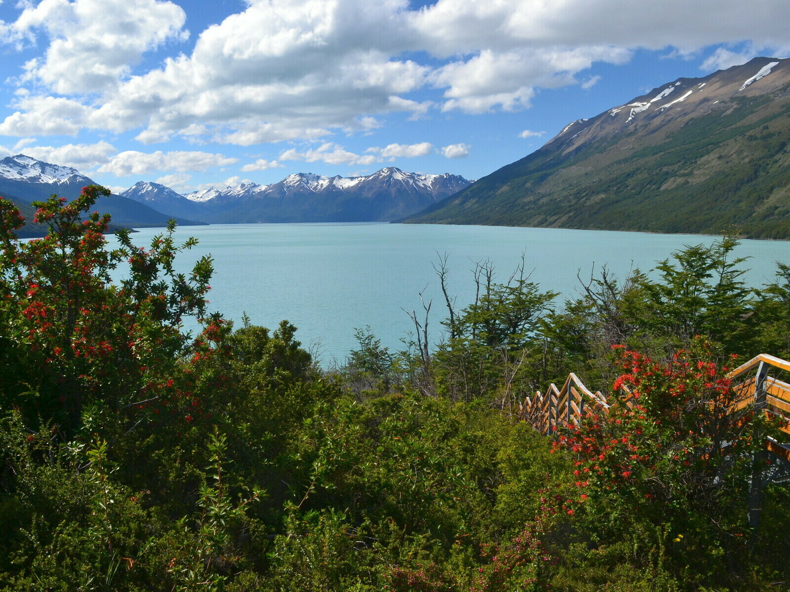
El Calafate was a quiet town that apparently lived out of tourism connected to the glacier. The lake that could be seen at sunset from the pub windows was fantastic, a scenario that was becoming familiar and the thought almost bothered me. The waiter called me caballero, as usual in Argentina and that made me smile. The journey was coming to an end so I decided the last two days should have been dedicated to visiting the Torres Del Paine park. So the next day I left early for Puerto Natales.
Therefore, Puerto Natales was the final destination of my motorcycle trip: no chance to reach Ushuaia but I wasn’t that sorry. It was far and probably not that interesting to see, at least according to what I was told.

The uniform landscape didn’t lose any of the wild charm of the northern regions. Indeed, the immense skies, the endless and increasingly uninhabited spaces made feel heading to the southernmost corner of the world even more romantic. I met almost nobody on the way down and it seemed incredible that so few people wanted to enjoy those the sight of those lands.

As I was heading back to Chile, the wind had grown stronger and more annoying: the jagged Andes line was gradually decreasing in height, the earth was becaming more flat, like steppe. The western wind was giving no respite and my bike was constantly being tossed from one side to the other of the road.
I remember there were no indications, none that suggested the direction for the state border and I missed the exit from the Routa 40 twice. As usual, it was a dirt road in poor condition, incredibly anonymous and with no signs. After a few kilometers, on the top of a barren hill the wind had become almost unbearable, even if this time it was blowing right against me. Fortunately beyond it, the wooden construction of the Chilean border appeared. Shortly after that I got to the small port of Puerto Natales.
Puerto Natales was a fairly quiet village, were it not for the amount of dogs that seemed to have nothing better to do than running after my mike while I was looking for the distributor and the hostel. The town had a pleasant center with a big supermarket, a handful of frequented streets, with fairly decent shops and cafes. I remember asking myself what people were doing for living, but all in all it was a pleasant place, considering the latitude and the remoteness.
I was dead tired, the weather was much dreary, with a cold sea wind that had long since frozen my hands.
Quite bizarre, the hostel was located inside a school building. At the time of my arrival there was group doing some sort of sessionin the assembly hall and the only other guest was a French man of a certain age who was also on a trip similar to mine.
His bike was parked in front of the entrance: a black BMW R1200 as big as an aircraft carrier with three metal trunks. My Honda looked like a bicycle in comparison.

Chatting with the man – a retired engineer – I learned it was his bike: he sent it directly from France with a Senegalese-flagged freighter. And for some incredible reason he had embarked along with it! He had spent almost 40 days sailing from Le Havre to Buenos Aires with only two stops, one in Southampton, the other in Dakar! Chapeau.
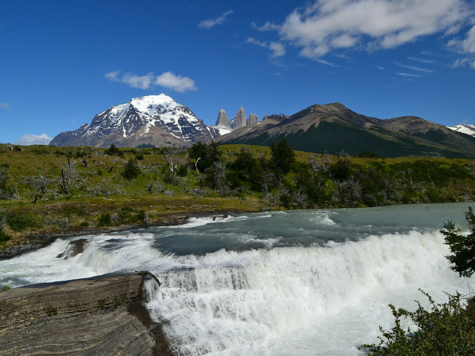
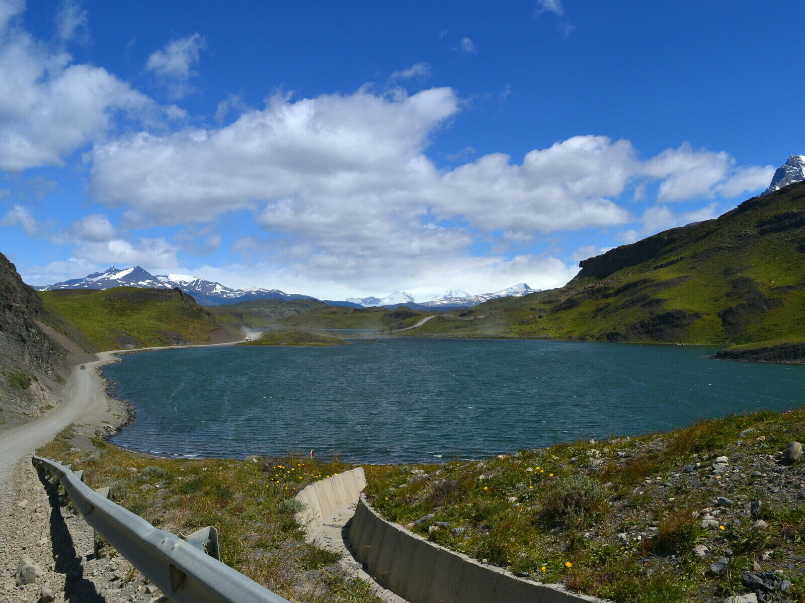
The next morning I got up early as always in order to make the most of the forelast day. The park of Torres del Paine wasn’t close to Puerto Natales at all, in fact. After an hour I had arrived at the entrance where two park keepers gave me a map illustrating all the possible destinations, as you could travel within by motorbike.

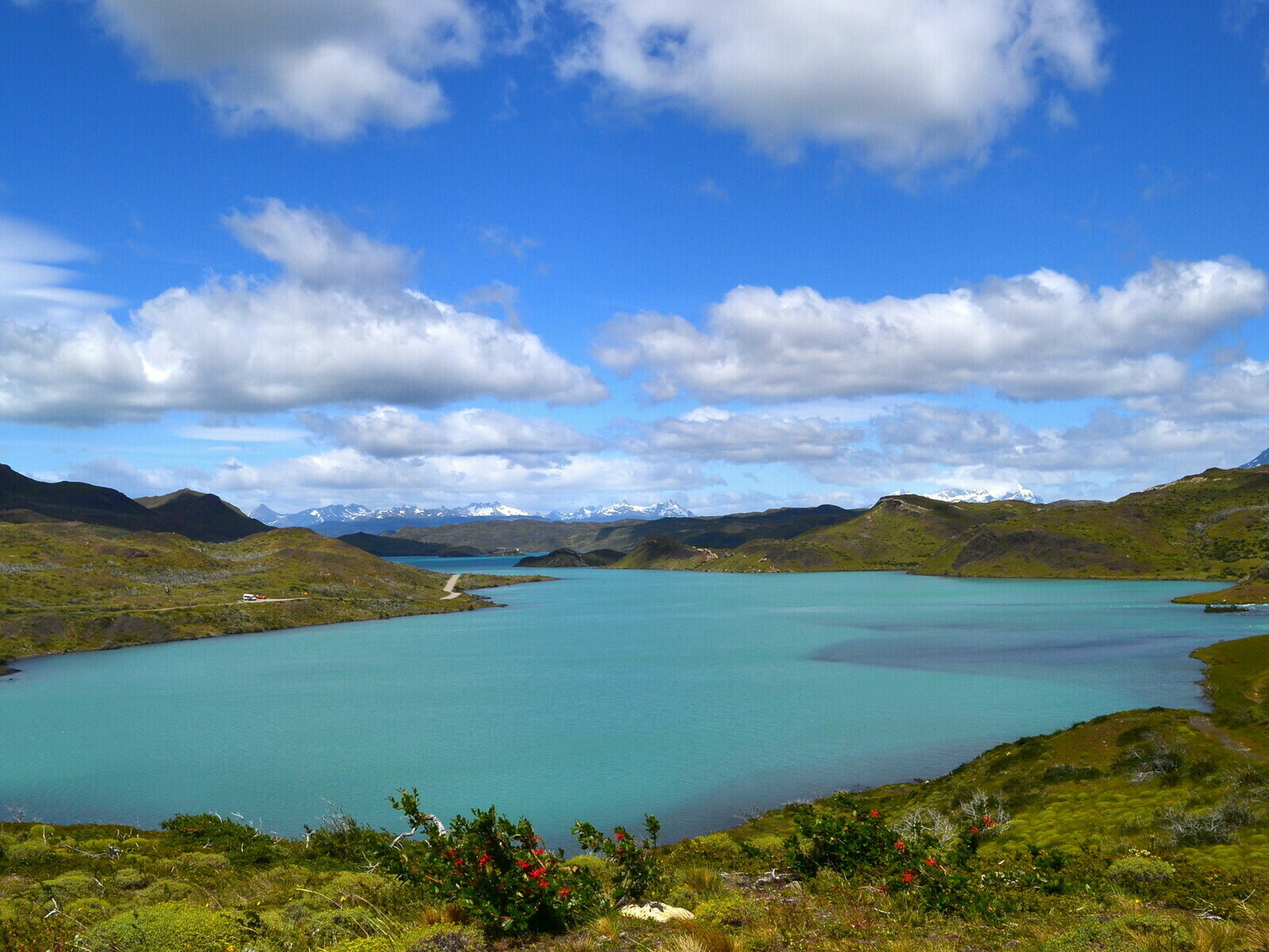
Unfortunately, my visit was far shorter than the three or four days needed to enjoyed most of the park. However, I planned three destinations, one of which included a trek to one of the lakes at the foot of the Towers. The bright green of the moor was unbelievable, and once again I asked myself how could water have those amazing shades of blue. It seemed like nature wanted to remember the real meaning of color to a generation of humans too busy corrupting them with their smartphones and their social media filters.

The next day, I left the bike to a local guy who was in charge of shipping it back to Villarrica and I took the bus to Punta Arenas with a certain sense of nostalgia.
I remember that in La Junta the owner of the hostel pointed out that Ushuaia, was not at all the end of the world. Figuratively meaning the place itself wasn’t that special and also meaning that geographically it was not the southernmost town in South America. The title semmed to belong to a certain Puerto William, a remote village of fishermen that lays further south, on the opposite side of the bay.
Whatever the end of the world is, the purpose of a travel is to enrich your soul. And I felt like this trip couldn’t have been better.