
Three years after
Looking back, one peculiar aspect of this trip is that it left a lasting impression on me, even though I didn’t have a clear destination in mind. I had casually stumbled upon a website featuring adventure trips, and from that moment on, I felt a strong desire to plan a similar adventure on my own. Sometimes, it’s challenging to explain why we become so passionate about something we have little knowledge of. This had happened to me years before with Iceland. However, the idea of this particular journey had been lingering in my mind for much longer, and it had, at the very least, originated from a chance encounter and a photograph.
At a certain point in my life, I began to yearn for trips that were uniquely my own. Pre-packaged tours or destinations like Ibiza, the Red Sea, Cancun, and the like didn’t quite align with my desire for a personal and authentic experience. I didn’t want to participate in something that was pre-planned and handed to me; I wanted to forge my own path and discover exotic and remote regions by myself.
In summary, I embarked on this adventure at the end of November 2017, and it turned out to be a fantastic and incredibly fortunate journey.

Sometimes adventures start at the airport
Over the years, I’ve developed a sort of survival instinct when it comes to long air travel, and I must say I’m rather proud of it. The airplane’s subdued ambiance, the notion that you can relax in your seat while watching a movie, and the complimentary food and drinks often make the experience quite pleasant. At least when compared to the everyday scenario where your chair is in an office and the monitor is covered in non-functioning code.
However, I’ve also cultivated a bit of skepticism about certain journeys, a kind of superstition, especially when it seems like it’s going to be an easy one. The more at ease you feel about it, the greater the risk of something going awry. Perhaps an insurance policy and a string of garlic cloves might provide some protection.

Layover adventures
In my case, fate had an encounter with me at Lima airport. My flight to Temuco was scheduled for 7 AM, leaving me with roughly 5 hours of layover time before boarding. Initially, I spent that time wandering around the boarding area in search of a chair to rest in before check-in. My mission, however, was a dismal failure, as the terminal was packed, and the chairs were occupied by people sleeping in the most awkward positions. At that point, I decided to sprawl out behind an unattended check-in counter, using my jacket as a makeshift mattress and my backpack as a pillow. As often happens when I have a few hours to spare before an important appointment, I suddenly woke up while checking my phone. The clock displayed a time just 10 minutes before boarding! I jumped up in complete astonishment and hurried to check in. Politely asking the folks around to let me pass, I noticed that my backpack had opened, and I had unknowingly scattered my toothbrush, soap, and towels while sprinting toward the desk. A few minutes later, the gate area was eerily empty. I approached two airline attendants who informed me that the flight wasn’t departing from that gate at that time. Surprisingly, they asked me why I was concerned, as there were still three hours to go. My phone had displayed 7:45, but it was set to the time in my home country. In reality, it was 3:45, and I still had three hours before boarding. The journey began with the rush of adrenaline from a true adventure, and for the next three hours, I tried to calm myself down by slumping into a chair in front of the gate.
The flight to Temuco went smoothly, and I had the chance to capture the magnificent Andes through the airport windows in the early morning light. I felt much better compared to a few hours earlier. Unfortunately, at Temuco airport, the baggage carousel kept churning out bags of all shapes and colors except mine. It became evident that my luggage was never going to appear. Stunned, I headed to the lost luggage counter, annoyed by the prospect of the potential troubles this could cause. The attendant reassured me that my baggage had been located and would be sent as soon as possible.
Obviously, that didn’t happen.
This turn of events left me stranded for two days, unable to move as I was tied up with phone calls and emails. Eventually, I decided to rent a motorbike and embark on a 200km journey back to Temuco airport, where I hoped my luggage had arrived. To my relief, it was there. The airport appeared deserted, with only a couple of cafes open, and the only two attendants in the terminal seemed engrossed in conversation while sipping coffee. When I inquired, they simply opened a small door behind them and retrieved my luggage from a closet. Typically, one might be annoyed by such a situation, but I was on vacation, the sky was clear, and I had a long journey ahead.
In the end, I shared a coffee with them, turned on some music, and finally set off.

Pucòn and Villarrica
My little luggage misadventure had turned into a delightful stay in the Villarrica Lake valley, and it was just the first of many surprises. The taxi driver who took me through the lush valley along the lake couldn’t have been friendlier, and the sunny weather made the place even more stunning. I was pleasantly taken aback by how nice everyone and everything was.
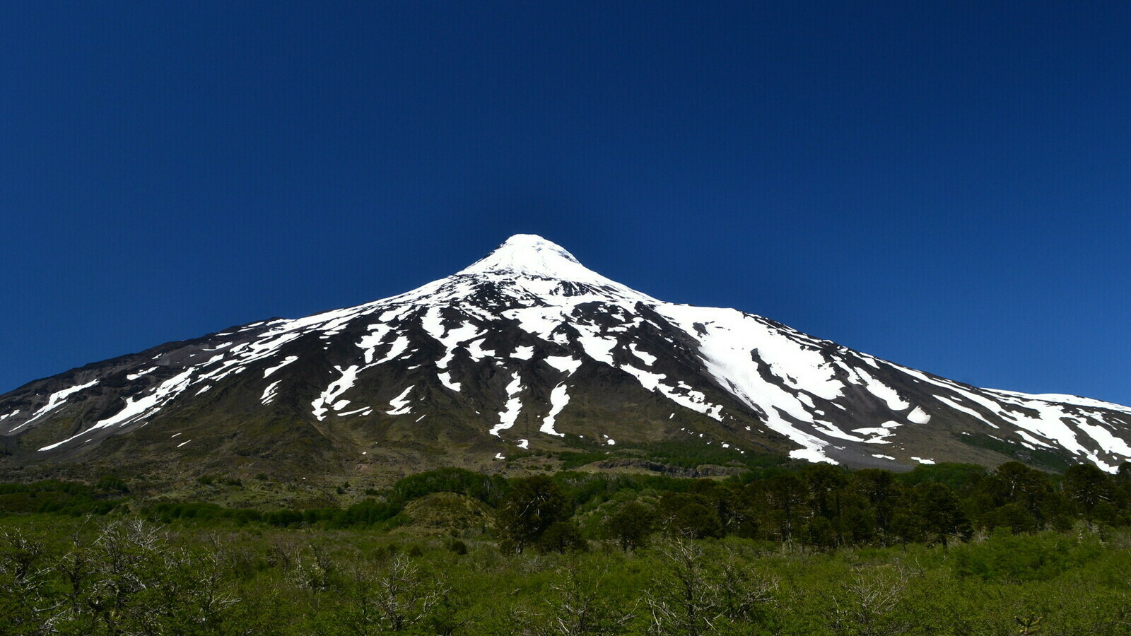
During my stay, I paid a visit to the owner of the motorcycle rental in Villarrica. His “shop” was nothing more than his house nestled in the hills between Pucón and Villarrica. The view of the volcano from his yard, as you can see below, was simply breathtaking. He became a kind of idol to me – living in such a beautiful place and doing what he loved.

Of course, it’s not like this all year round. In the winter, it’s rainy and cold, and in the summer, the area can get crowded. But I’ve often found myself daydreaming about it while stuck in my office on rainy days.
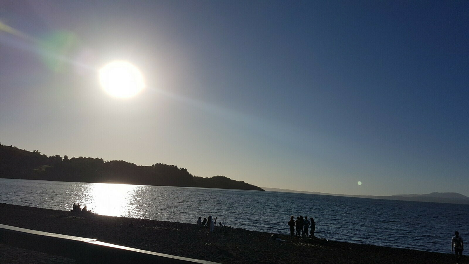
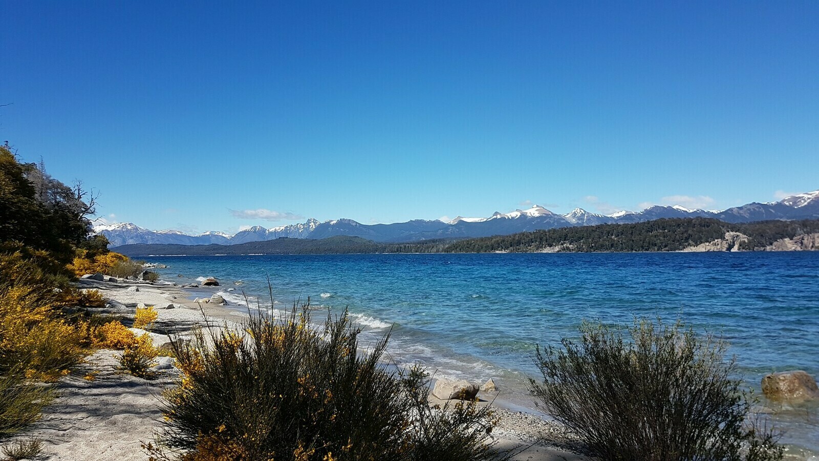
While Villarrica was a decent-sized town with no standout features, Pucòn and its surroundings felt like a paradise. The valley was lush and filled with lakes, and Pucòn itself sat on the shores of the largest one. It was a village of wooden houses, hostels, and small restaurants that seemed, at the very least, to defy my preconceived notion of Chile.
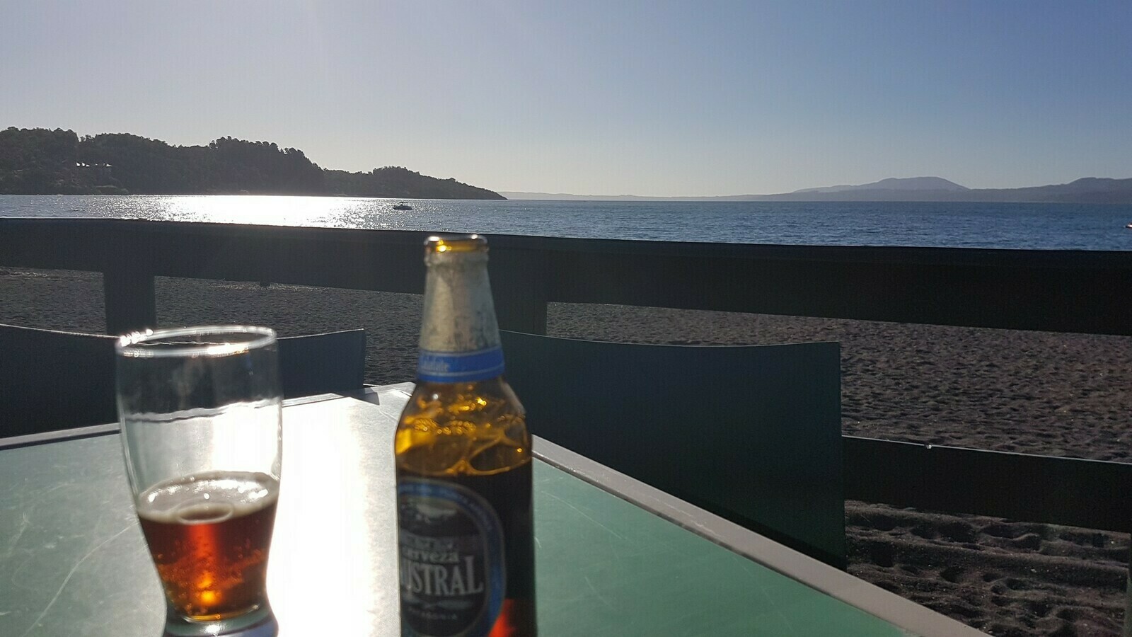
During those three sunny days, my favorite spot was the pebble beach. There were only a few people sunbathing here and there, and the beach bar facing west was the perfect place to enjoy a beer while waiting for the sunset. Appropriately enough, it was called “Patagonia,” and it even won over non-beer lovers like me with its surprisingly excellent brews.

When the time finally came for me to start my journey, I made my way to Ulli’s rental in Villarrica. As I mentioned before, it wasn’t just a garage; it was a villa with a massive backyard that offered a breathtaking view of the Villarrica volcano, which made its volcanic activity seem like a mere afterthought.
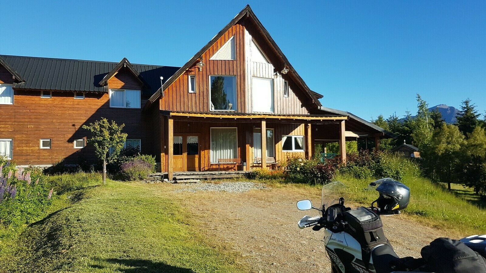
Inside, the motorcycle was getting its final check while I was busy signing all the necessary paperwork. The rental was definitely on the expensive side, although it was in line with the prices of other rentals in the region. Looking at the price list for spare parts, I couldn’t help but shudder, so I opted for comprehensive insurance. The bike itself was a brand new Honda CB500X, equipped with a new off-road rear wheel, saddlebags, a tank bag, maps, a full tank of gas, and all the essential documents needed for crossing the border. Ulli and his wife were incredibly kind people, and they provided invaluable assistance during those days when I had to deal with Latam regarding my lost luggage.
I was so happy when my journey started but I have to say I was already regretting not having time to explore the valley.
Destination Argentina
I was already contemplating how to speed up my plans a bit to make up for the days I had spent leisurely in Pucòn. The road leading to Argentina, in my mind, marked the beginning of my “real” journey, and it passed through a mysterious park that extended all the way to the border at the base of the aforementioned volcano, Villarrica, and another stunningly beautiful one, Lanin.
Little did I know that this was just the beginning of a series of parks that shared a striking similarity: they stretched right up to the border, had dirt roads meandering through them, and were surrounded by breathtaking landscapes.

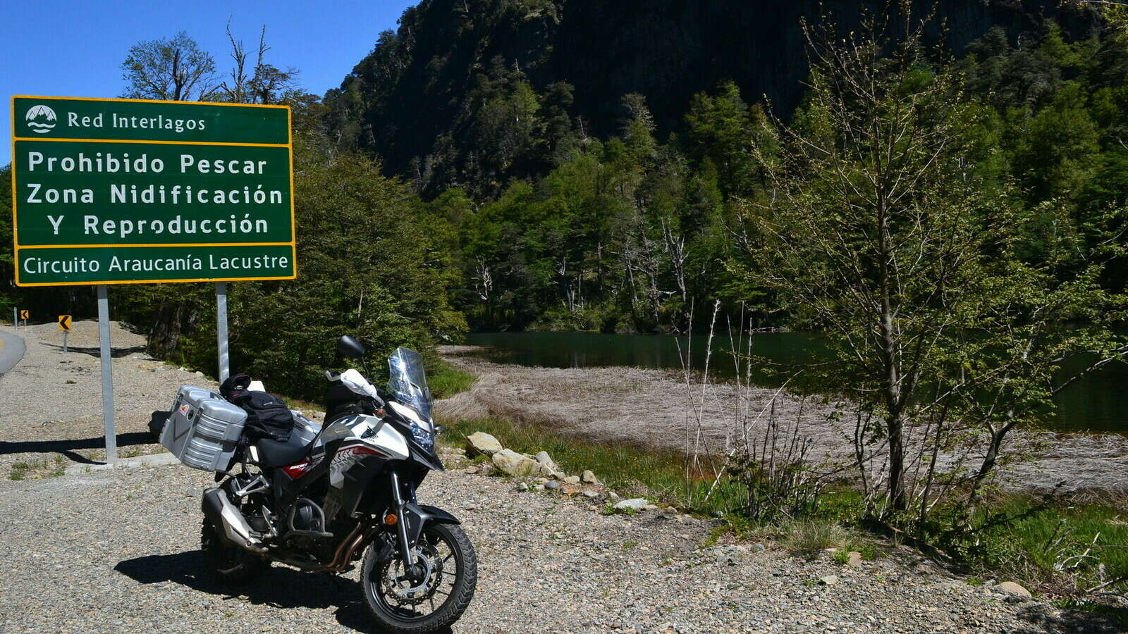
Although many roads in southern Patagonia were unpaved, all roads going through through the parks were inevitably like that: covered with a thick layer of gravel and often full of potholes.
The first day of off-road riding felt like a baptism by fire. I lost my phone holder, which fell off as I grappled with the road’s grooves, which seemed quite common, and the layer of loose gravel on top of them. I was quite exhausted after that ride, and Ulli’s earlier question about how comfortable I was with dirt roads suddenly made perfect sense.

Fortunately, I would soon become more familiar with it all. Nevertheless, that first day was spent navigating wooded hills, attempting to get comfortable with the bike, the roads, and the GPS navigator I relied on.

Mindful of my experience in Iceland, I kept my camera within reach, anticipating numerous stops to capture the breathtaking landscapes. However, I wasn’t entirely at ease on the gravel roads, and the bike was constantly sliding. Moreover, I had no idea what to expect at the border. How could a border between Chile and Argentina possibly be? I had no clue, but images from TV shows like “Narcos” kept flashing through my mind – images of soldiers, machine guns, and barbed wire.

With great relief, amidst the woods, a serene station emerged, resembling a small gas station. There were no intimidating signs, no barbed wire, no armed guards in sight.
Inside each station, there were several counters you had to visit in a specific order. Each of these counters dealt with your documents, typically involving the process of filling out and stamping papers.
In general, the process went smoothly and usually only involved a couple of questions about the motorcycle and your destination. More often than not, the border officers would greet you with a smile, ask about your vacation, and wish you a pleasant journey. This was a stark contrast to the stern demeanor of border guards back home, making it feel like you were on a different planet.
The Routa 40 de los 7 lagos
A few minutes after crossing the border, the road transitioned back to being paved, just before connecting to the more famous “Ruta de los 7 lagos,” or “Ruta 40.” This road traverses the entirety of Argentina, running from somewhere in the north to the far south.

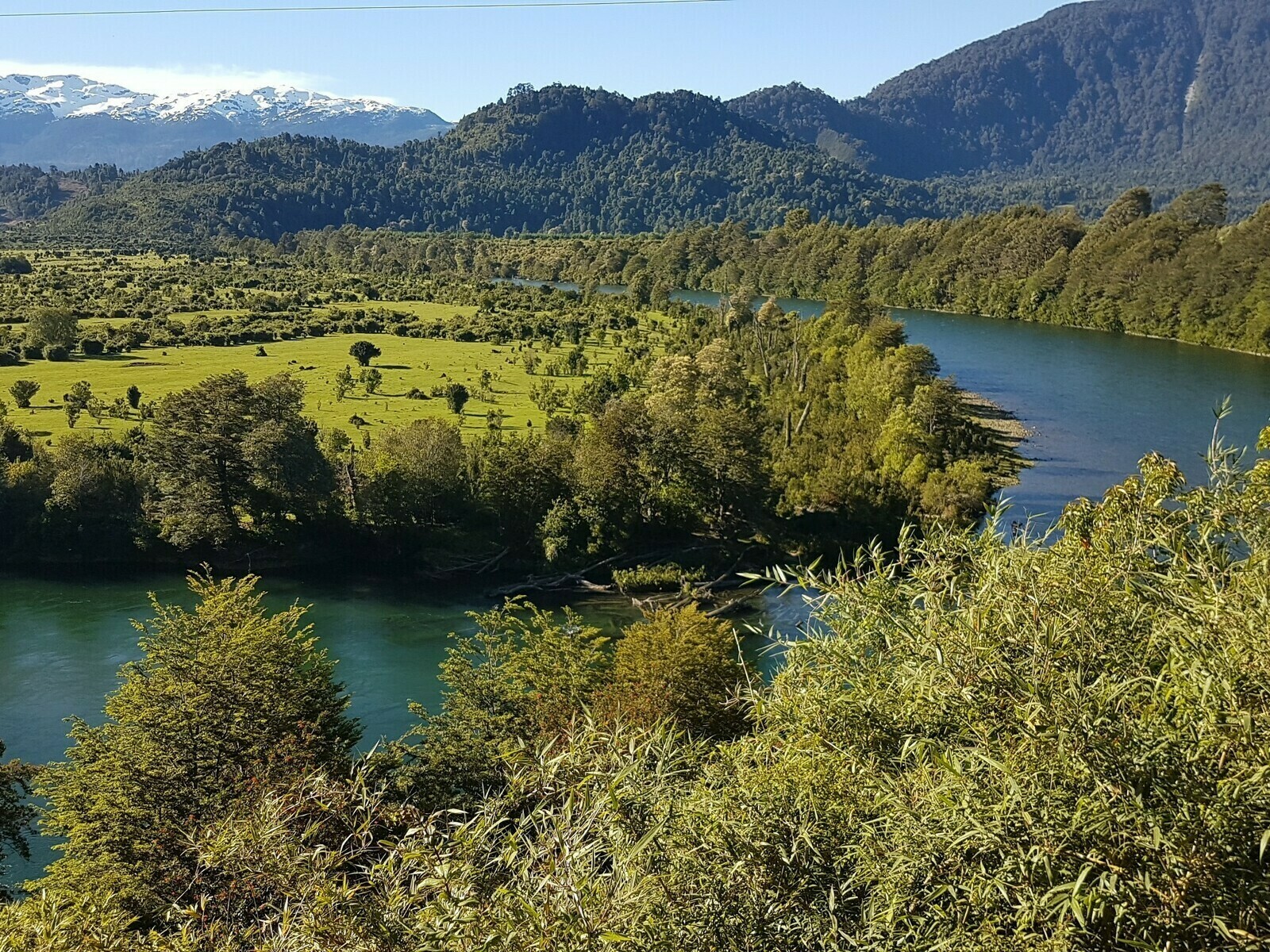
That stretch entered a mountainous area dotted with amazing blue lakes and covered by endless forests. I also marked the entrance of the Argentinian Lake Distrinct.
After a somewhat uninspiring stretch past Junin de Los Andes, I reached a place called San Martin de los Andes. It was a charming village situated on the shores of a picturesque lake, which appeared to be a serene summer retreat that had somehow escaped the attention of tourists during that period. As I meandered down the main street, everything was tranquil except for a group of bikers with a distinctive yellow roadster enjoying a break at a café. I decided it was an ideal spot for a rest.
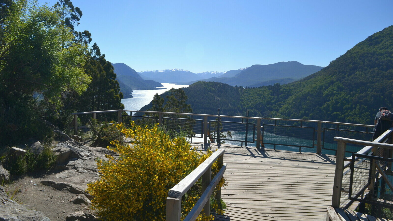
In a nearby park, a group of youngsters was rehearsing a hip-hop song in the shade beneath a tree. After withdrawing some cash from an ATM, I settled at an outdoor table at a delightful bar on the street. Engaging in a conversation with the waitress, I discovered there was a lookout point outside the village to the left, albeit not easily accessible as the road was unpaved. However, the view of Lacar Lake beneath the radiant spring sun was a remarkable reward, as was the scenic road that traced its shoreline after departing from San Martin.
After spending two extra days in Pucòn, I decided it would be a good idea to pick up the pace. My next planned stop was Villa la Angostura, a lovely place that seemed a bit more ordinary compared to the previous destination. The local youth hostel was comfortable and conveniently situated just behind the main road’s central intersection, where I found a restaurant that had an authentic local vibe.
I was eager to try local cuisine, and the specialty of the region was the “trucha”, which I had no clue about despite my Spanish. So, I opted for a delicious deer stew instead. As it turns out, trucha is trout. Lesson learned.
Back at the hostel, I had a chance encounter with a friendly German kite-surfer and a fellow motorcycle rider. The motorcyclist was embarking on a solo journey to explore the southern part of the world.

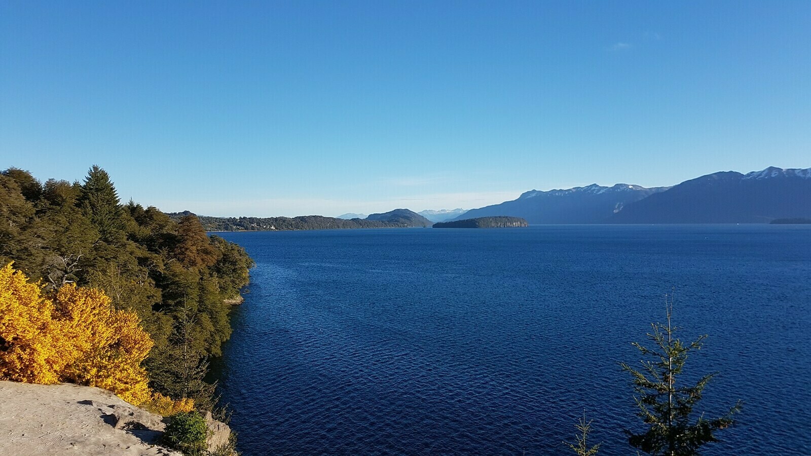
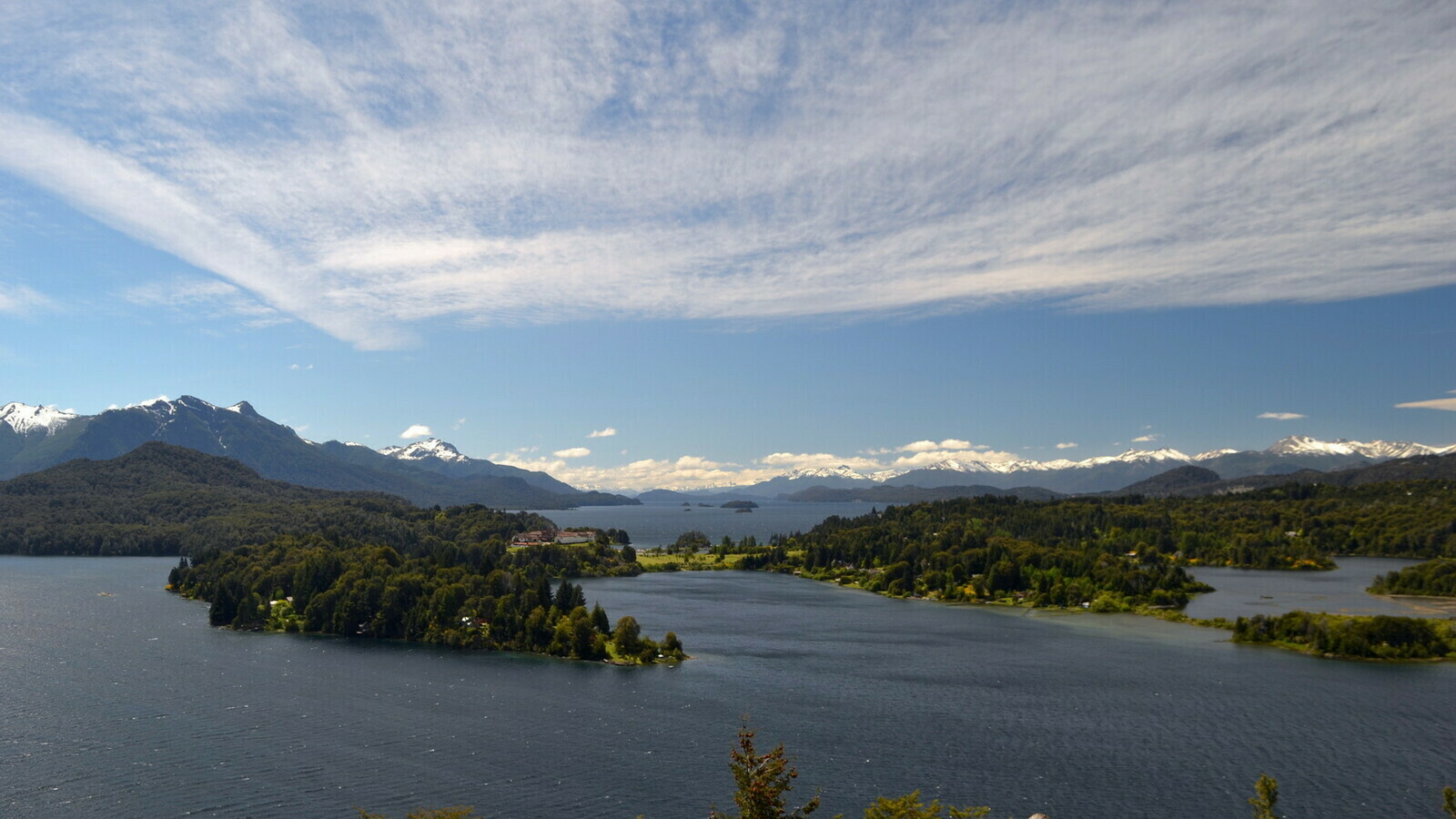
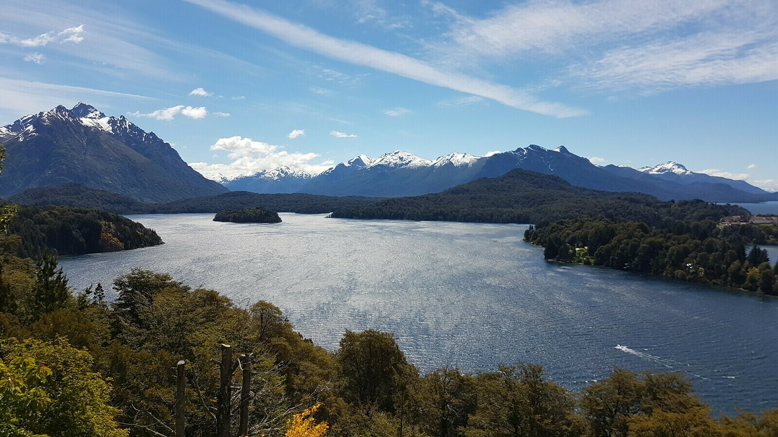
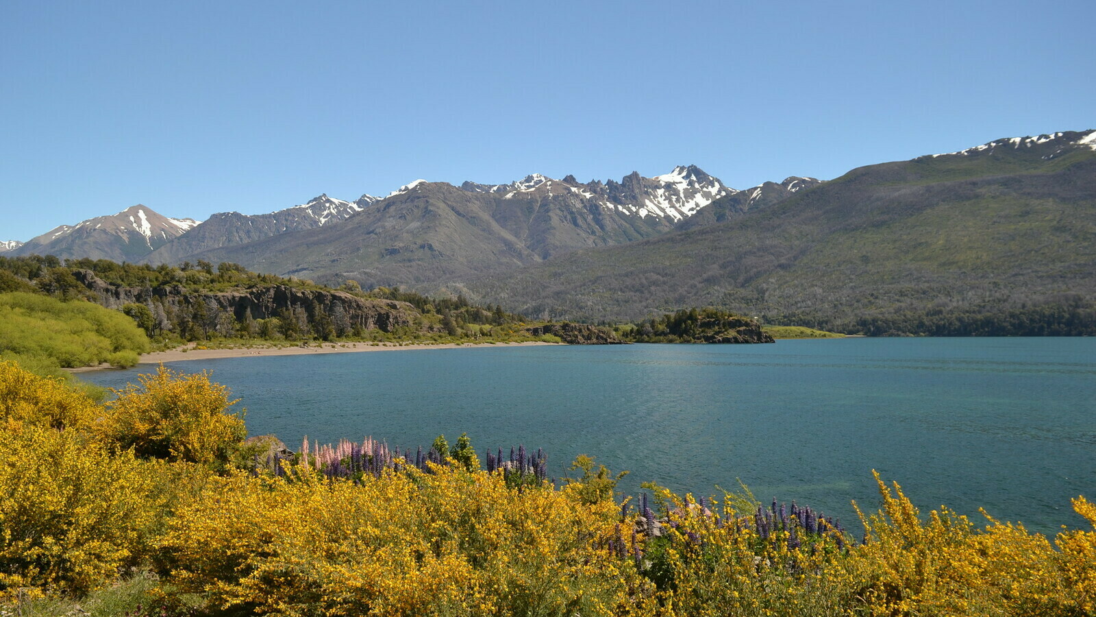
Caribbeans? The next stop was the famous region of San Carlos de Bariloche, a renowned summer destination. Villa la Angostura was a charming village located right at the start of an incredible road that followed the vast and breathtaking Nahuel Huapi Lake and the national park that encompasses it.
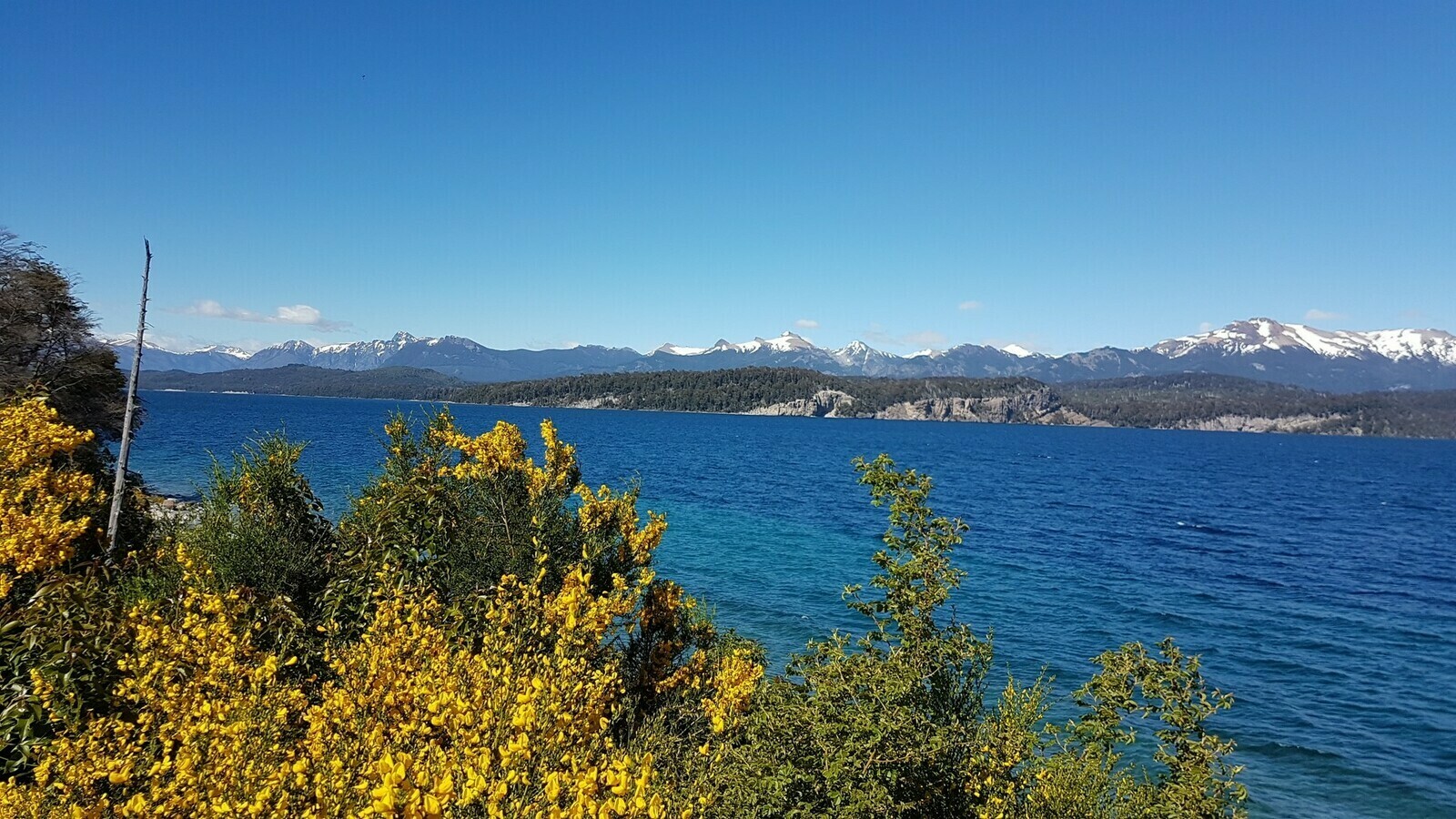
The road wound its way around this vast, crystal blue lake, framed by fields of yellow flowers and flanked by snow-capped mountains. Undoubtedly, this was one of the most visually rewarding segments of the entire journey.
During a break, my curiosity got the best of me. The shoreline of the lake should have been just beyond a line of blossoming bushes. I ventured through them, and when I emerged on the other side, I was deeply moved by the sight before me: an astonishingly deserted beach, one of the most beautiful I’ve ever encountered. It felt as though someone had transported a Caribbean beach into an alpine scenario.
The Gilera fun club. Reluctantly, I had to tear myself away from that paradise. I suddenly realized I had neither the gear nor the time for sunbathing on a beach, especially with my schedule pressing on. As I continued along the same road, I encountered fellow motorcyclists on vintage bikes. A bit further down, at a lay-by that looked like a terrace and offered another perfect photo opportunity, I met the entire group: a dozen elderly gentlemen riding, who were (hear ye) the Argentine Garelli and Gilera Fan Club! These were two long-extinct Italian brands that existed only in my childhood memories. It was simply astounding. We spent some time exchanging stories about our respective journeys and shared most of the remaining, wonderful road to Bariloche. Among other things, they informed me that we were crossing the shortest river in America: the Correntoso, which measures just 200 meters!
San Carlos de Bariloche
At the end of the breathtaking journey around Lake Nahuel Huapi, I finally arrived in San Carlos, one of the larger towns in the area that locals simply refer to as Bariloche. It was an attractive place with a strong reputation as a tourist resort. According to the Garelli Fan Club members, it was also dealing with the challenges that often accompany mass tourism, such as speculation and petty crime. So, leaving bags and helmets unattended on the bike was not advisable. In reality, aside from witnessing two policemen in white helmets riding off-road motorbikes with shotguns on their laps (reminiscent of scenes from the Narcos series!), sitting by the lakeshore, the town looked magnificent.

The main street appeared rather elegant and lined with shops, and the city itself seemed tidy enough and tranquil despite the rumors. Within one of the galleries, I exchanged euros for pesos at a fair rate with a gentleman who provided some form of “unofficial” money-changing service on the street corner, all under the watchful eye of local police. In fact, it was a policeman who pointed me in his direction. Once more, we engaged in a conversation about my journey, this time in Italian, as it turned out he had once been involved with an Italian woman.
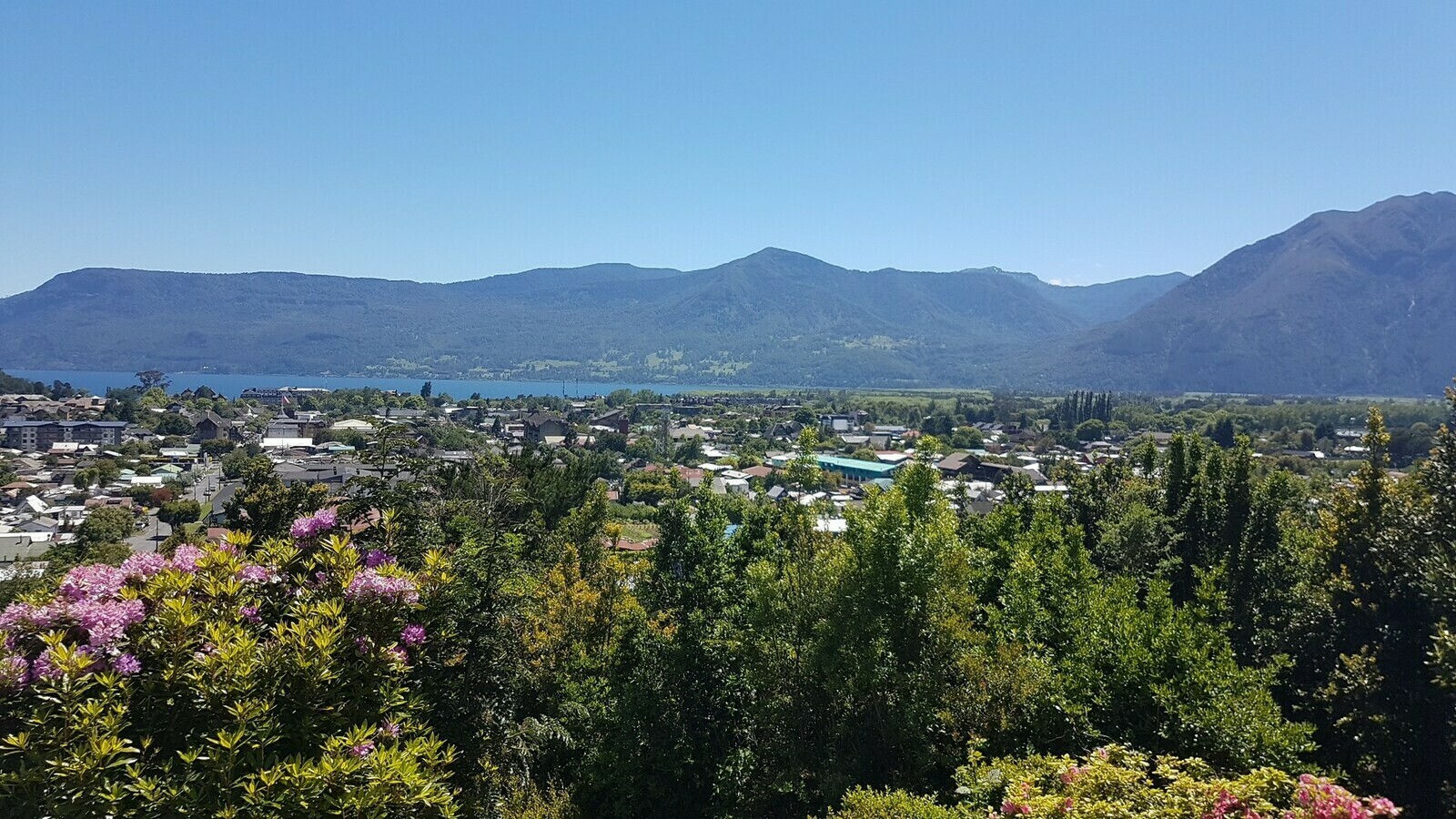
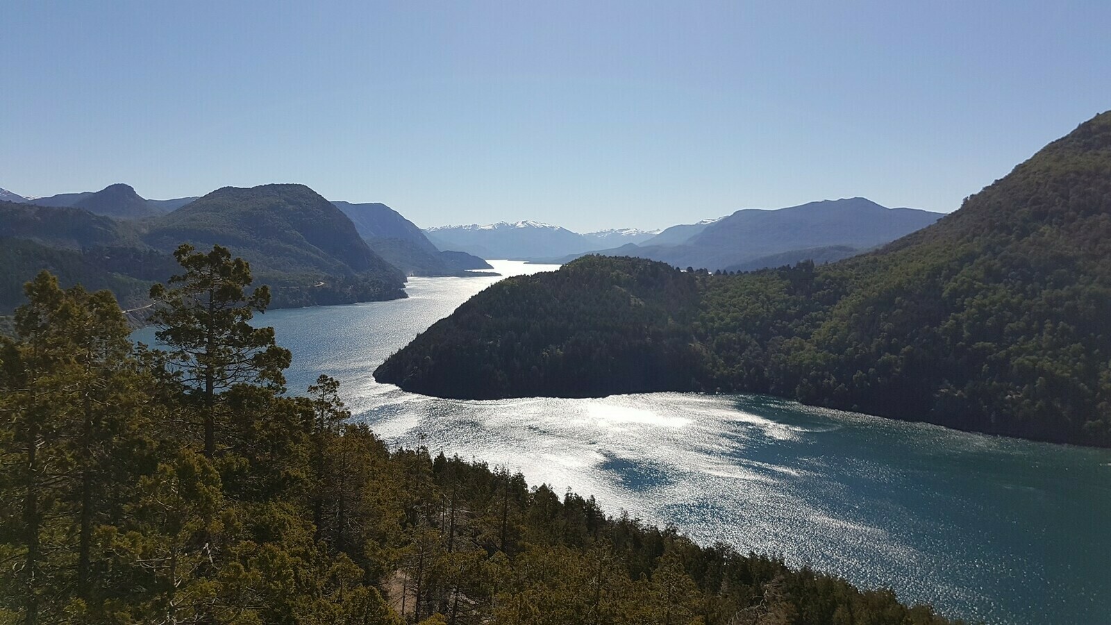
Llao Llao. It’s not located in Chinatown but is among the most recommended places around Bariloche. Regrettably, due to time constraints, I hadn’t initially planned to stay in town. However, my German friend was quite insistent that visiting the small peninsula just to the left of town, Llao Llao, was a splendid idea. Therefore, before journeying further south, I opted to prolong my visit and explore the area known as the “Chile Chico ring,” which is the road that circles the hill.

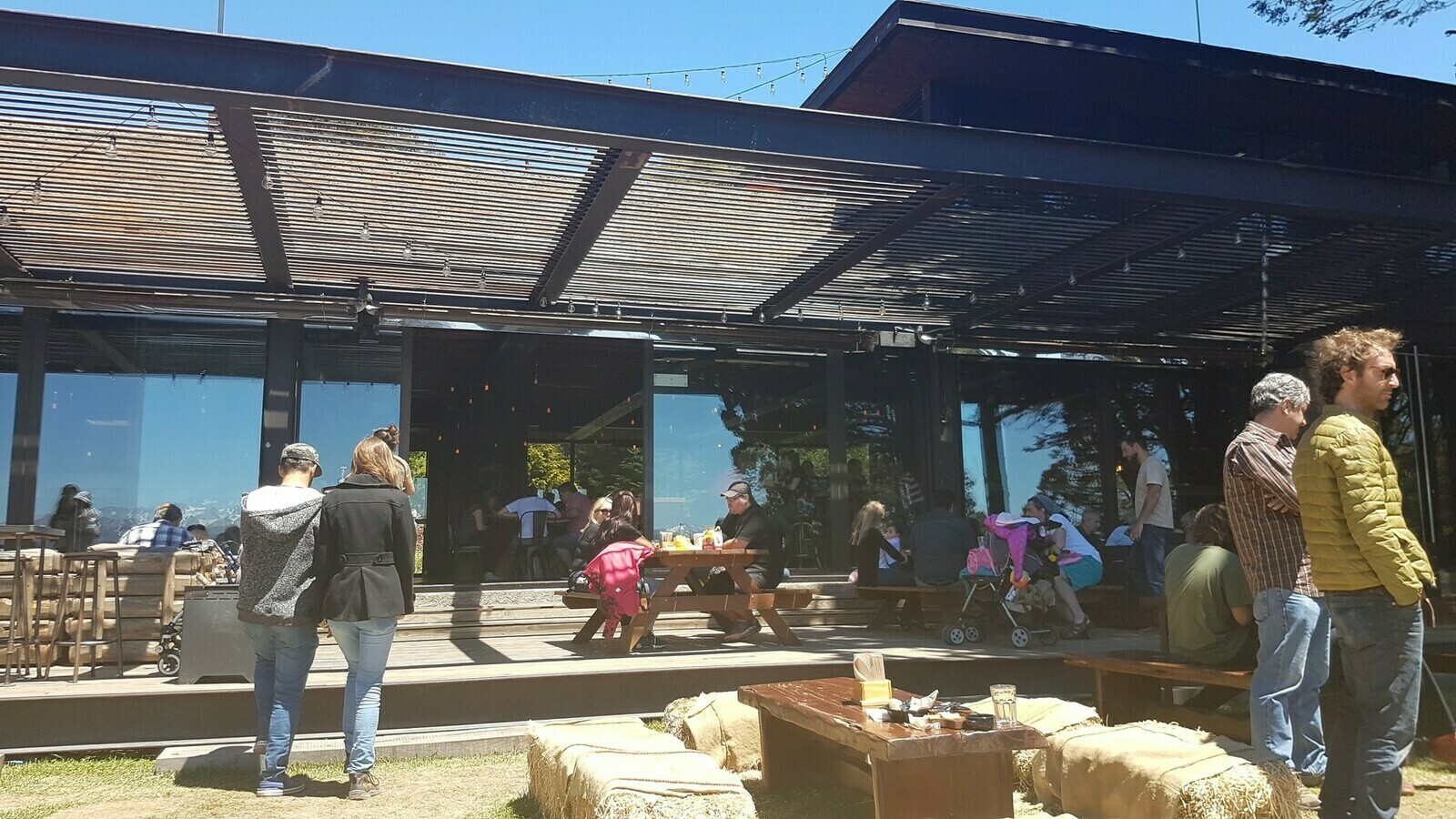
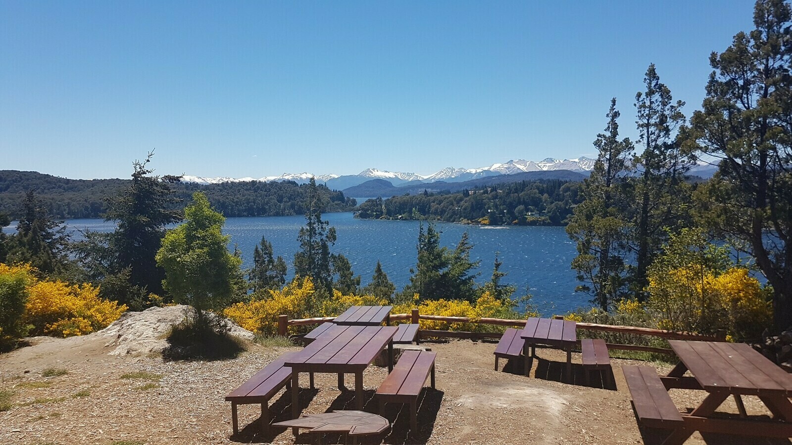
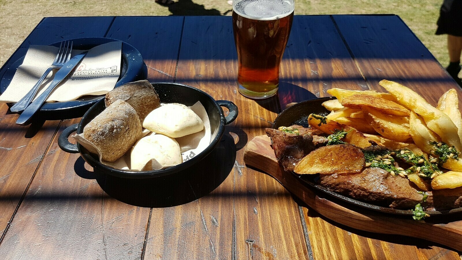
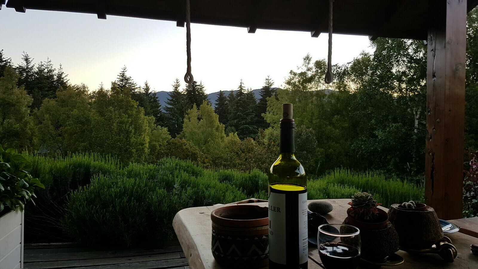
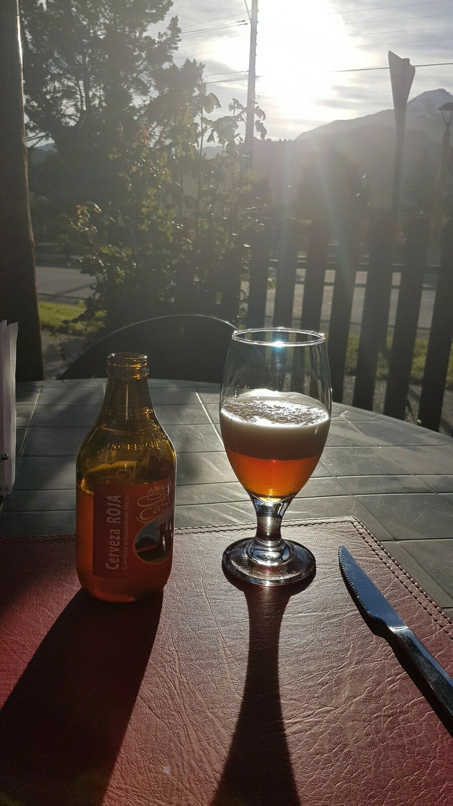
Some of the region’s finest breweries are situated on the hillside in Llao Llao. We’re not talking about your typical pubs or factories; these cervecerias resembled fancy resorts. The road meandered along the hillside, passing by some lovely beaches adorned with vibrant orange, yellow, and purple flowers. As it ascended, it offered the most spectacular vista of the lake and its surrounding park you could ever imagine. Take a look at the picture at the top of this post. Towards the end of my tour, I made a stop at one of the highly recommended breweries: Cerveceria Patagonia. While the name may not have been particularly original, it was one of the most picturesque places I encountered throughout the entire journey. Nestled on the hillside overlooking the lake, it featured a garden with a cottage and a terrace that offered a breathtaking view. I settled down at the restaurant, relishing an exceptional amber beer alongside a steak and potatoes, all beneath the radiant sun and with an incredible panorama before me. Patagonia had already won me over.

South of Bariloche, El Bolsòn
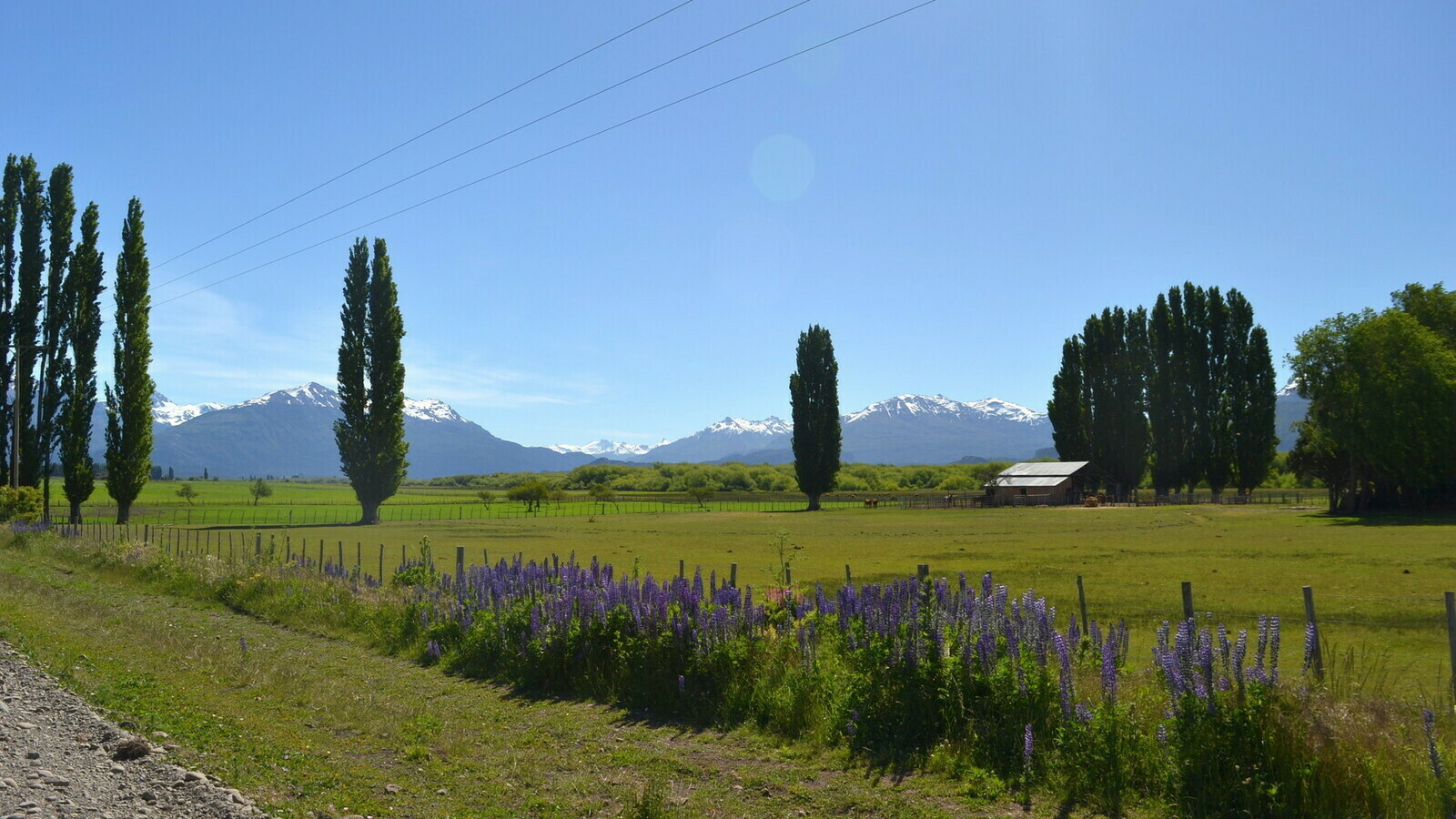
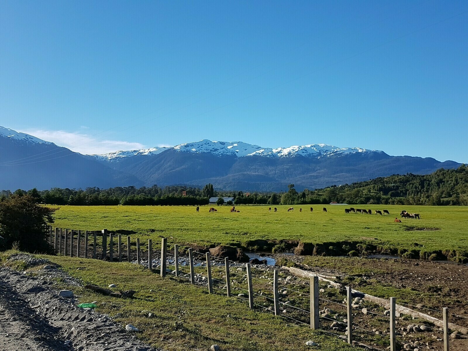
As I ventured south from Bariloche, the landscape underwent a gradual transformation. Mountains receded into the distance, roads straightened out, and the forests and lakes grew increasingly sparse, making room for a gentler and more open terrain. It seemed less frequented, yet no less beautiful. These were the final verdant vestiges of the region before the vegetation yielded to the windswept and arid expanses of the Argentine Pampa.

I must admit, I loved that stretch of road: a lengthy, sunlit, and straightforward route, flanked by wide valleys, meandering streams, and scarce human presence. It was an ideal afternoon for a motorcycle ride. Furthermore, for some inexplicable reason, I found myself repeatedly encountering vibrant rally cars heading north at regular intervals. There were dozens of them. Whatever the reason, they exuded a sense of coolness, adding yet another positive note to the day.

They were once hippies. My destination was El Bolson, a village with a name as peculiar as its reputation. It was renowned for being a hub of the hippie community, at least during the clue period of the hippie movement. Reportedly, only a handful of them still existed in the area, living off the land and, as I was told, wandering around semi-naked while bartering goods with their neighbors.
Encountering a road blockade. Something else I discovered was that a few days prior, a tragic incident had occurred: a young boy had lost his life during protests involving the local indigenous community. They were protesting against the sale of their lands. Consequently, there was a significant police presence in the region. When I reached the village, the main road was obstructed by a protest. Despite some burning tires, it seemed relatively peaceful. I navigated around the area through side streets and stopped at a grocery store to grab a sandwich. At the time, I was unaware of the details of the protest. The store owner’s response was somewhat ambiguous when I inquired. It struck me as odd, like someone who didn’t want foreigners to develop a negative impression of the place.
A risky overtake. To add a bit of excitement to the day, I found myself indulging in a rather Italian-style maneuver on the road. There was an unexpectedly long queue for some unknown reason, and I decided to weave my way through the line of cars by slipping past a few trucks. The issue arose when I reached the source of the traffic cones: a police patrol was conducting checks on people entering and leaving the village (likely due to the recent protests). Fortunately, I managed to evade any severe consequences, such as a hefty fine or having my motorcycle impounded, which I probably deserved. The officers stopped me, but I escaped with just a strange anecdote.
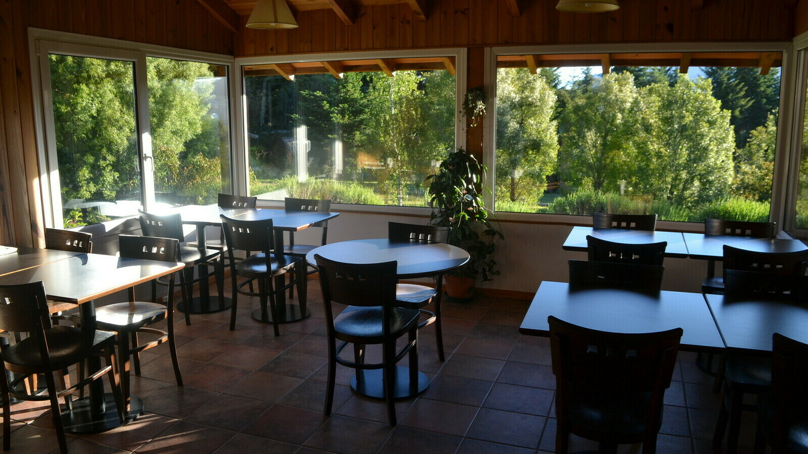
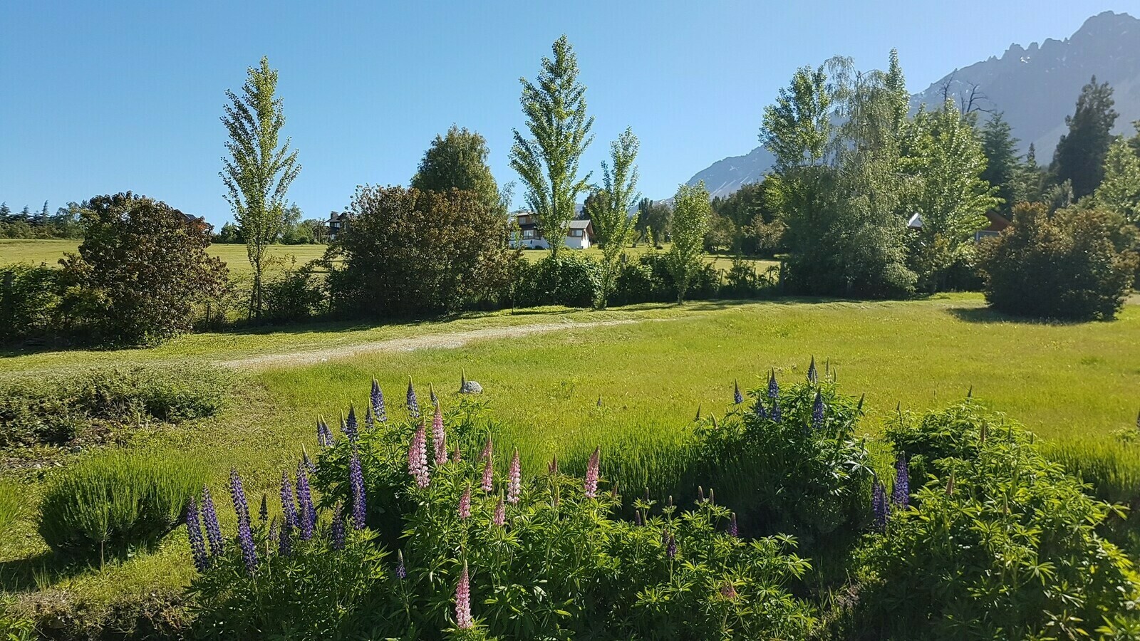
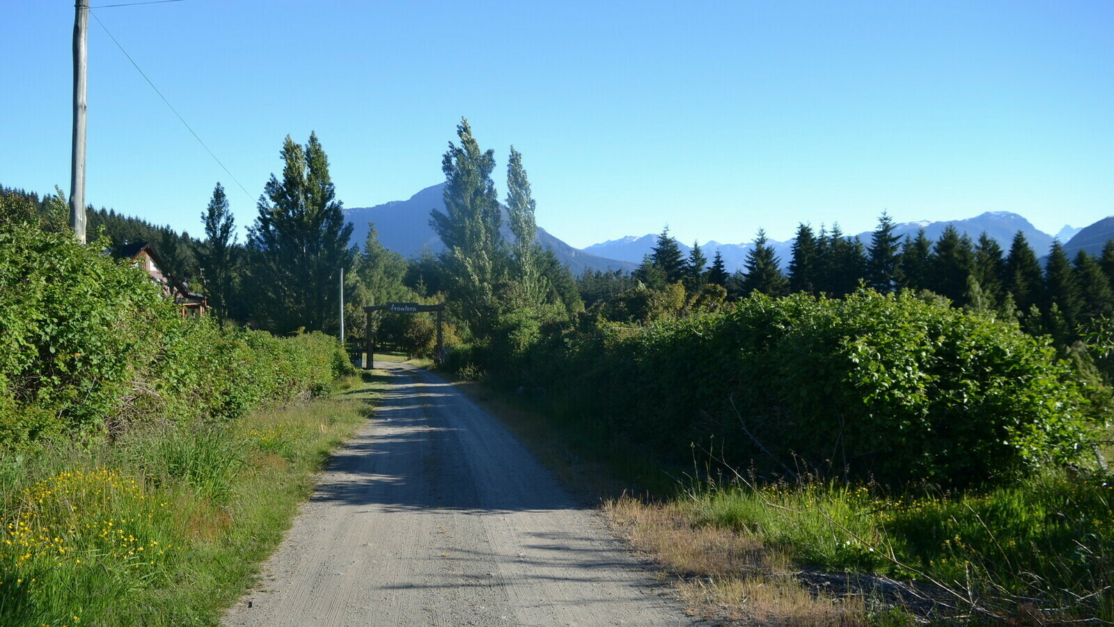
A remarkable hostel. At the end of that eventful day, I finally reached my destination: the hostel in El Bolson. It was called Frontera Hostería y Cabañas and was situated in Las Golondrinas on the outskirts of the village. Of all the hostels I’ve ever stayed in, this is one of the two I wholeheartedly recommend. It was a beautiful wooden farm with a lush garden, two dogs, and numerous cats. What made it even more special was the incredibly kind family that managed the hostel. The place exuded charm and coziness inside. The owner had Italian origins, hailing from Massa Carrara, and his wife prepared a sumptuous breakfast complete with homemade cakes. I enjoyed this feast on the veranda of their wooden home.

Parque de los Alerces
The next stop on my journey was the village of Futaleufú and its namesake river, located across the border in Chile. The gentleman at the rental shop had highly recommended this place, and perhaps more than ever, I had no clue what to anticipate in an unfamiliar destination with such an unusual name. Initially, I contemplated continuing straight south, completely bypassing the village and the entire western portion of Chilean Patagonia. However, my intuition told me that this region would be captivating to explore. It turned out to be a fortuitous choice: the river was absolutely stunning, and the entire Aysén region was undeniably a must-see destination.


As I continued down Route 40, I noticed a road branching off to the west, traversing the hills and heading straight towards the state border. I realized that there was a vast park nestled in between these two roads. The route was cutting diagonally through this lush expanse before reconnecting with the main road shortly before the border. Despite adding some extra length to my journey, it appeared to be a picturesque detour. So, why not explore it?
Before reaching the park, the landscape was gradually transforming into a more Pampas-like terrain. Forests began to recede, mountains retreated into the distance, and the surroundings evolved into a flat, arid landscape. Considering this transition, exploring the park seemed like an appealing idea, offering a welcome diversion from an otherwise monotonous journey along a straight road with few captivating features.

Parque de los Alerces. A magnificent valley stretched out right at the park’s entrance. As the road ascended along the hillside, the scenery became even more spectacular. It was a brilliantly sunny day, and I couldn’t help but feel that the lush green fields, farms, horses, and blooming flowers transformed the area into a true paradise.

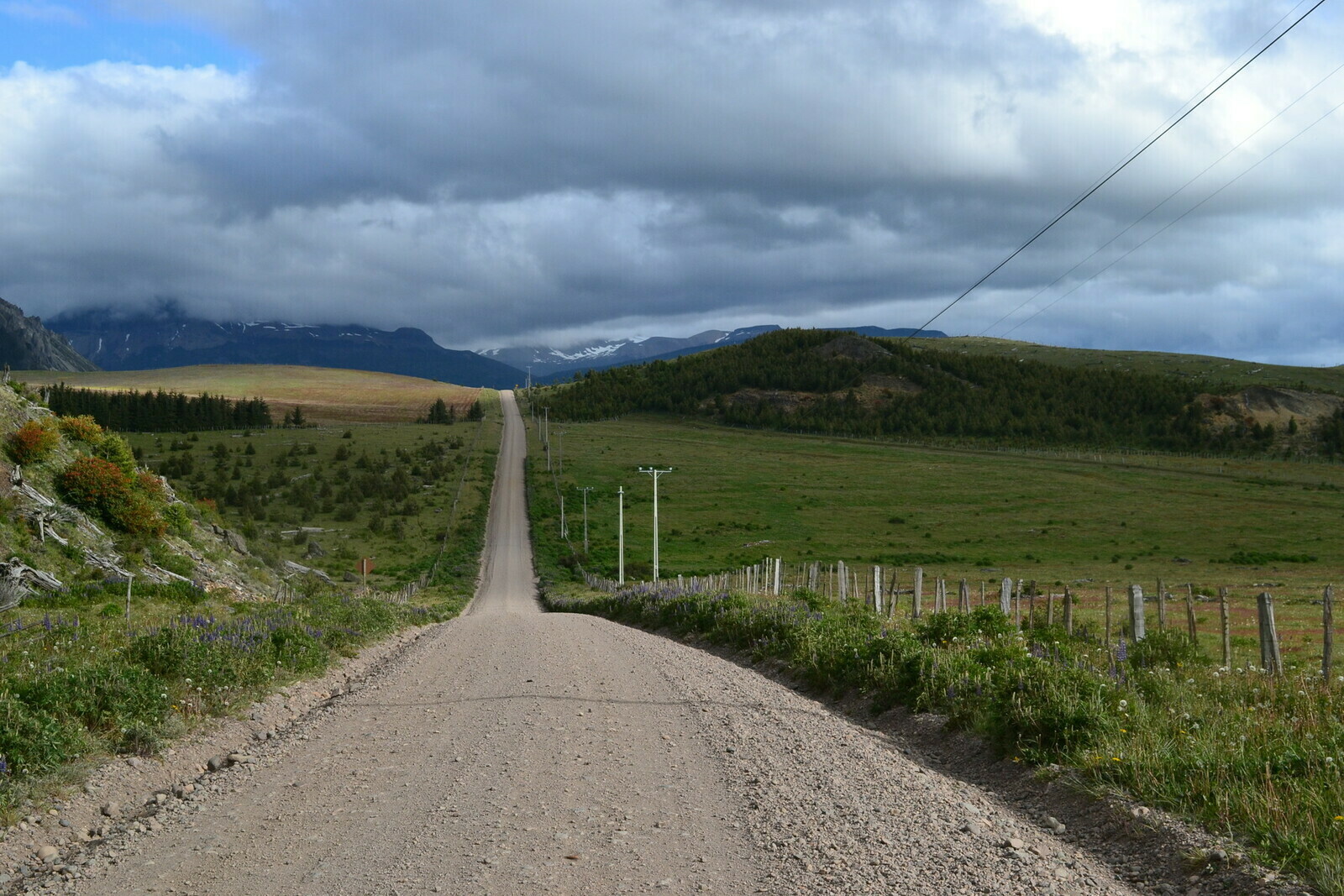
I recall being amazed by the sparse population in the area. Just as I had discovered earlier, every road passing through these parks was unpaved. The park itself was beautiful, and the road wound through forests and past several lakes for over 80 kilometers. I took my time, making frequent stops for photos. However, as the day progressed, the road started taking a toll on my body. My journey involved navigating through a fair share of dust, rocks, and potholes.

The seemingly endless road abruptly emerged from the woods, revealing a green and flat valley with snow-capped mountains in the far distance. It felt as if the mountains had eluded me while I was in the park. The road rejoined the one leading to the border. I recall passing through a small, sunlit village where the roads and houses were so far apart that it brought a smile to my face, reflecting how different it appeared compared to the my city.

The few kilometers that separated me from the Chilean border unfortunately involved an unbelievably narrow, winding, and miserable unpaved road. My exhaustion only exacerbated the situation, and I couldn’t help but wonder how two countries could have such a poor road connection.
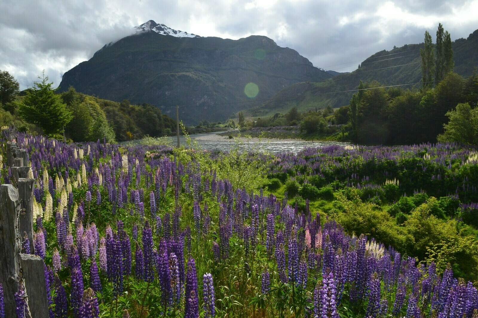
However, in the late afternoon, the road finally led me to a bridge that spanned the mysterious and stunning Futaleufù River. This unexpected sight immediately made it clear why so many had recommended this route.

As I would later discover, the river itself was one of the top five destinations worldwide for rafting enthusiasts. Whether you were into rafting or not, it was a place of remarkable beauty. This beauty felt even more exceptional because there wasn’t a soul in sight, except for a few cars on their way to customs, kicking up huge clouds of dust.
The bridge spanning the river marked the symbolic border between the two countries, and it was nothing like what I had envisioned for a border. The small customs house, where the border guards were stationed, was barely discernible among the trees a few hundred meters down the road on the other side.

The village of Futaleufú adhered to a common Patagonian pattern, characterized by a grid-like layout with neatly squared streets and a central square adorned with a garden. After a few kilometers of riding on the dirt road from the border, I reached the village. Futaleufú, despite its small size, maintained the familiar layout. Surprisingly tranquil despite its popularity among rafting enthusiasts, the village was well-equipped with hostels, bars, and agencies offering activities such as rafting, kayaking, fishing, and cruising. All of this was quite remarkable for a place that seemed to have fewer than a couple of thousand inhabitants.

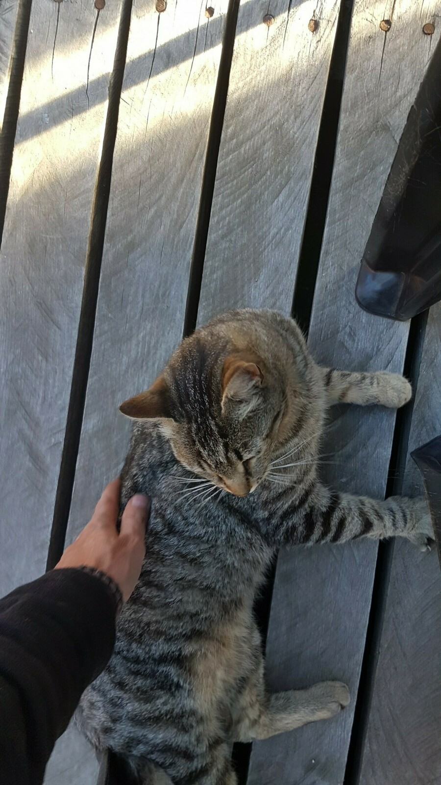
In the central square, you could find several bars, one of which was particularly charming. This establishment not only served food but also boasted the distinction of offering some of the priciest craft beer in the entire country. Upon my arrival, the only patrons present were a cat and a couple of Americans. I vividly recall overhearing their inquiry about internet availability, to which the waitress wittily replied, “It’s not; talk to each other.”
The half-Brazilian girl made an unintentional epic fail when attempting to tell a joke, which led to an inadvertently rude response. I couldn’t contain my laughter, and I subsequently joined the couple at their table.
The girl was from a northern European country, while the guy, originally from Oregon, was a pilot who owned a small touristic plane back in the States. They were both very pleasant, but to be honest, he came across as a bit eccentric. Not because he was spending every winter in Patagonia searching for a piece of land to invest his money in, or even because he believed that a nuclear war between his country and North Korea was imminent – an event I considered quite unlikely. It was because he found humor in the idea of living in Patagonia while nuclear warheads might be flying across the ocean toward his homeland.
While his attitude might have seemed peculiar, it did make me contemplate doing something similar – buying land, not giggling.
The hostel on the town’s outskirts was the quintessential youth hostel catering to individuals who I kept believing I still belonged to. It was brimming with friendly young people, most of whom were ardent enthusiasts of rafting or trekking.
Regrettably, the following day, I had to depart without the opportunity to partake in any river activities. The road persisted in being dusty and unpaved, running alongside the pristine, crystal-clear waters of the river.
The region of Aysen and the wild Patagonia
Beyond Futaleufù, the dusty, serpentine road meandered along the valley to the west without offering many noteworthy points of interest.
The road seemed fairly unremarkable, except for the entrance to a park, where signs posted warnings about potential encounters with pumas and other wild animals. These signs also provided guidelines on how to behave if you happened to come across one of these large felines – emphasizing that running away was not a wise course of action.

Once more, after a few hours on that road, I found myself covered in dust to the point of being nearly unrecognizable. Many of these roads have a convex profile, meaning they tend to slope toward the road’s edge. So, when encountering left bends, you have to navigate a counter-slope on an unstable surface.
As a result, there’s a risk of losing your grip and veering straight into the ditch. Unfortunately, that’s precisely what happened. The bike stumbled and jolted from one rock to another. Just when I was almost convinced I would tumble in the worst possible way, resulting in both myself and the bike being covered in bumps and scratches, I miraculously managed to slow down and come to a halt.
The greatest swim. In need of a break, I pulled over at the side of the road. To my amazement, just a few steps below, I discovered one of the most stunning ponds I had ever seen. The water was a crystal-clear blue, resembling those picturesque images travel agencies use in tropical holiday advertisements. I couldn’t resist the temptation. With not a soul in sight, I decided to seize the moment. I undressed completely and indulged in the most refreshing 30-second bath of my life!

My friends from Norway might have considered the water perfect. As an Italian, I couldn’t exactly describe it as warm; it was more like “my heart could stop at any moment.” However, the sensation was incredible, making it one of the best and most memorable moments of my journey.

The road crossed the river one last time, passing by a small dock typically used for rafting boats. The water’s color changed once more, and once again, there was nobody around: no boats, no tourists. This solitude made the scene appear even more special as I crossed the bridge over the river for the final time.
The Carretera Austral. Suddenly, a paved road came to my rescue, leading me down into a lush green plain. It wasn’t long before I reached an unassuming T-intersection: I had arrived at the famous Routa 7, a north-south road in Chile that was the equivalent of Argentina’s Routa 40. This road stretched from somewhere in the north all the way down to a small village called O’Higgins, situated at the very southern tip of this continent. Even though it wasn’t my ultimate destination, I couldn’t help but contemplate how intriguing it might be to journey down to O’Higgins. The name sounded far from Spanish and was likely linked to some prominent historical figure, given that it wasn’t the only place on the map with that name.

The road was narrow yet magnificent, with a splendid sun blessing the day. I encountered very few cars, and I couldn’t help but wonder why so few people lived in such a breathtaking region. According to a hostel owner, it was mainly due to the vast distances and poor connections. However, that explanation didn’t seem entirely convincing, even though many parts of the main road were quite literally under construction.
La Junta resembled the other villages I’d seen: nestled amidst lush forests, it had the customary square at its center with mostly two-story buildings. At the hostel, I had a lengthy conversation with a local meat trader who kindly invited me to a barbecue organized by some farmers further south, near Cochrane. I had to reluctantly decline the invitation, although it would have been an epic experience. These people were incredibly welcoming and hospitable, just as I’d encountered throughout my journey.
To make the most of the beautiful sunny day, I embarked on a trip to a place called Lago Verde. It meant another stretch of dirt road that felt a bit tiresome by the end of the day, but it also treated me to yet another fantastic view of this remarkable region.
Down to Coyhaique and the General Carrera lake
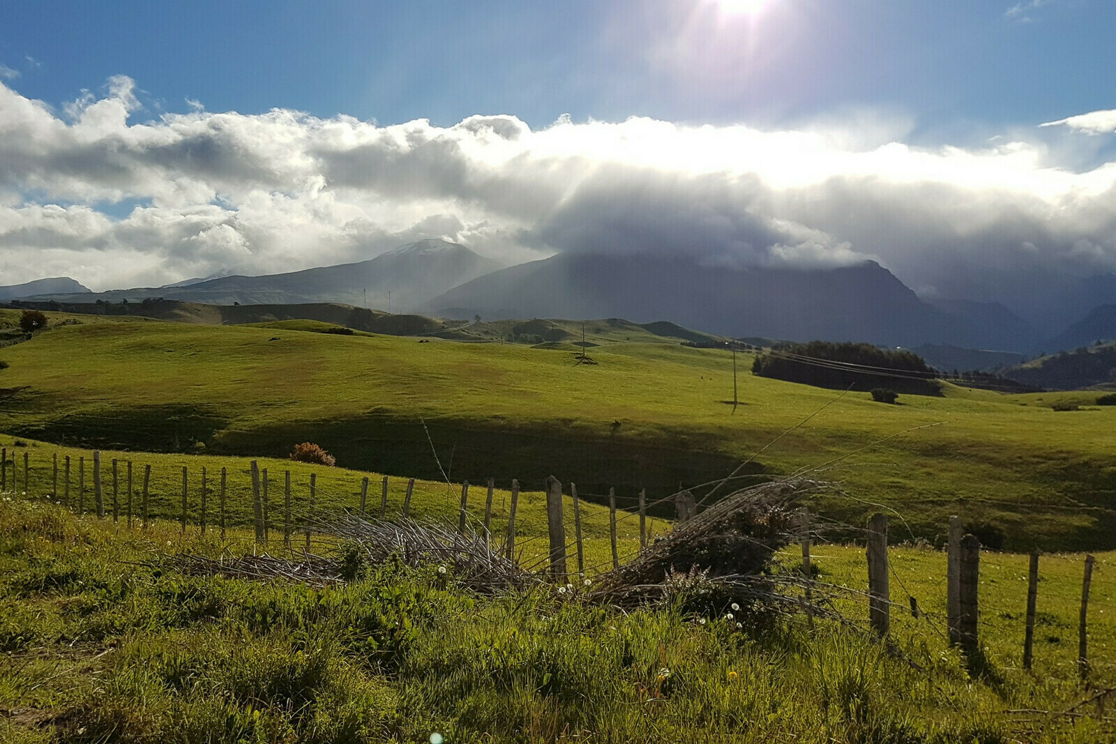
Following my short visit to the village of La Junta, the next day I set out for the region’s capital: Coyhaique. The road between these two places led through a peculiar and untamed area, characterized by mountains, fjords, and forests. I noticed that the weather had begun to shift, transitioning to what was probably more typical for the region. Unlike Argentina and its Pampa, Chilean Patagonia tends to be much colder, more humid, and rainier. Consequently, it was a gray and rainy day, which was a rare occurrence during my entire journey.

The road I was traveling on seemed to be the sole link connecting this region, and it remained largely incomplete. Within minutes, the road would transition from smooth, well-paved asphalt to a bumpy, dirt path riddled with potholes, zigzagging up a mountain or clinging to the edge of a fjord.
It was an amazing and heartwarming experience for me to notice that every time I passed through a construction site or a working area, the laborers would frequently stop what they were doing, raise their hands, and give me a cheerful greeting as I rode by. This gesture of friendliness was truly heartwarming! I responded by waving back, and at one point, while I was riding along a fjord, it felt as though I was in a race with the workers enthusiastically waving their hands and shouting, spurring me on as if I were nearing the finish line!

In the Aysen region, the weather often appears to be quite forgiving. As I continued my journey, the skies had quickly darkened, and by mid-morning, a light drizzle had begun. Surprisingly, this drizzle added to the beauty of the region, giving it a mysterious and captivating atmosphere, similar to what I had experienced in Scotland. The road continued along the fjords, which reached deep into the land, with the snow-capped mountains in the background, making the day’s journey even more enthralling.

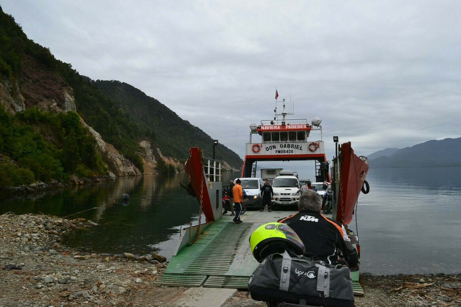
By midday, I reached a point where the road was completely interrupted due to ongoing roadworks. To continue my journey, I had to board a ferry that would transport all vehicles to the other side of the bay. This situation seemed unusual for a main road, but it was likely necessary because heavy equipment was reshaping the mountainside to restore the only road in the region.
A small group of bikers was already boarding the ferry just ahead of me. They were a mix of Argentines and one Italian. It turned out that the Italian traveler had an almost identical name to mine!
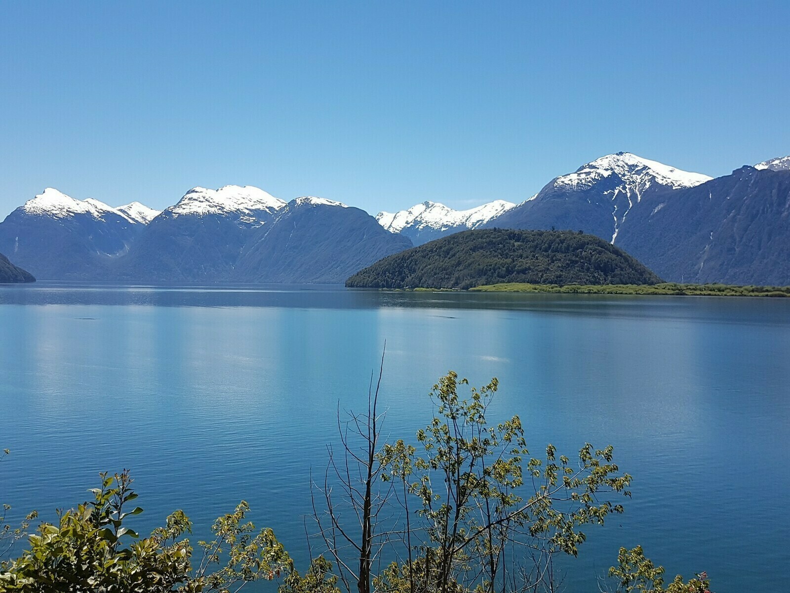
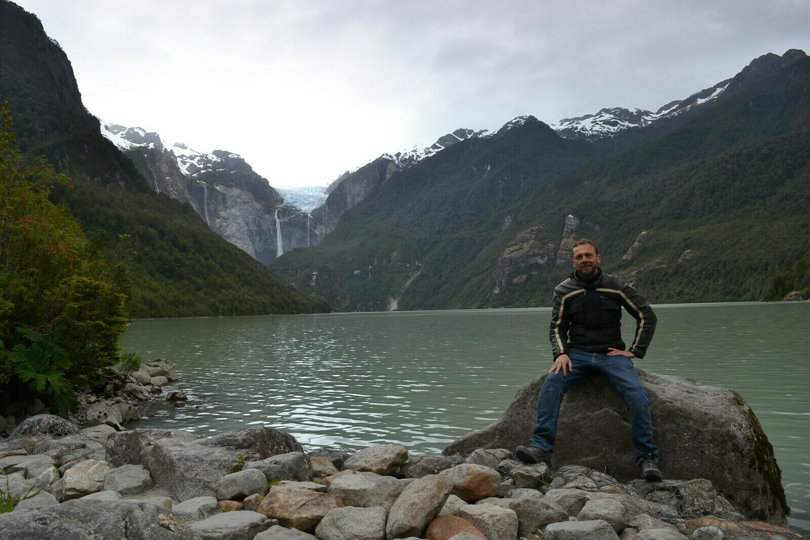
We continued our journey south towards Coyhaique together, making a quick stop at the Queulat Park. This was a lovely natural reserve with its main attraction being a boat tour across a lake and up to the base of a glacier. The glacier was slowly moving, shedding chunks of ice into the lake. Spectacular waterfalls descended from its base high up in the mountains, dropping for hundreds of meters. If you waited long enough, you could witness blocks of ice tumbling down in what felt like slow motion from that great distance. The sound reached us several seconds after the ice fell, creating the sensation of witnessing something in another dimension.

The next portion of the road to Coyhaique led me through some modest yet charming villages, and as usual, there were various roadwork sites in progress. These roadworks added a touch of adventure to the journey since the bike had to navigate around holes and cracks in the road.
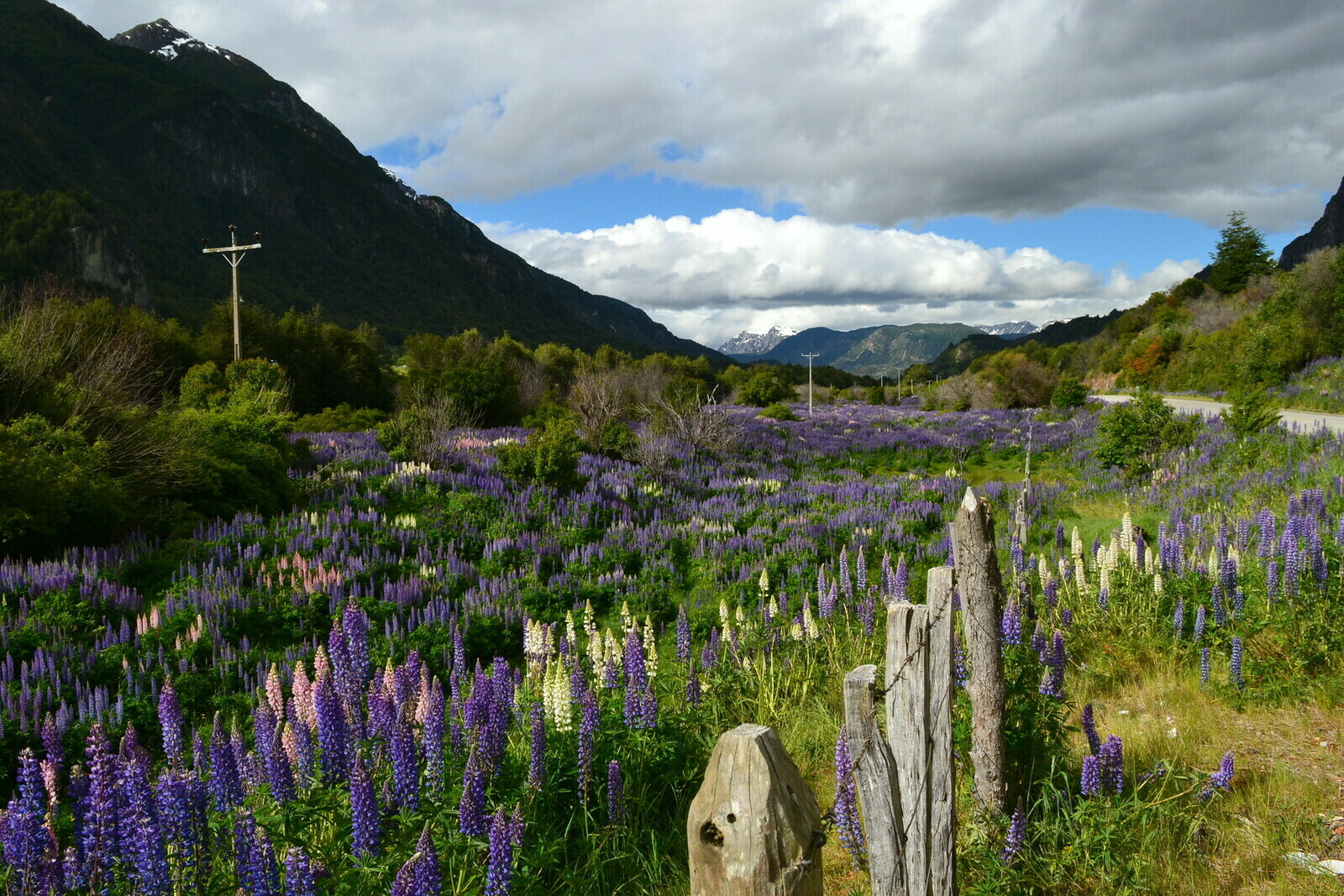
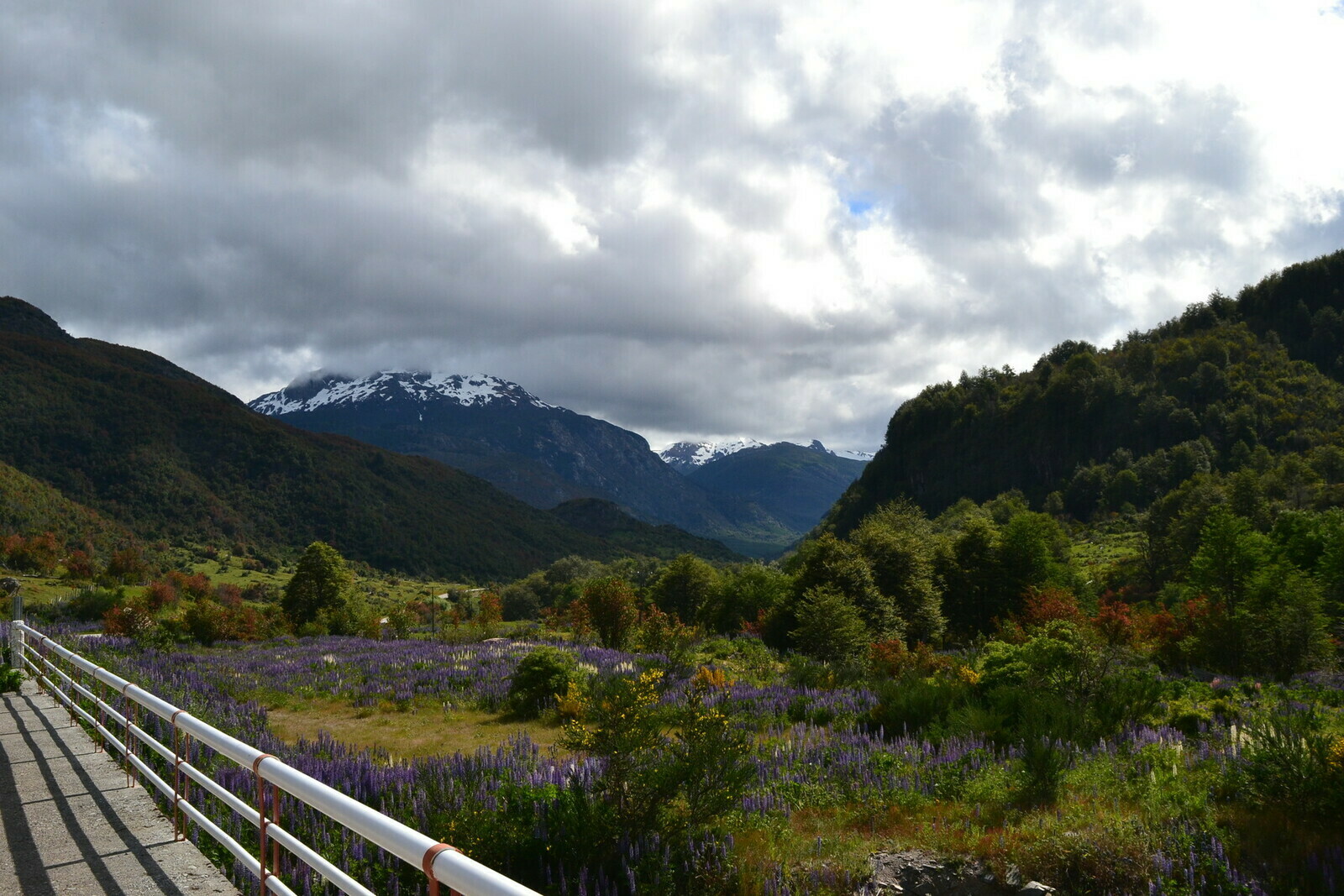
After passing through Villa Maniguales, I had a choice to either continue on Route 7 or take a detour on the somewhat mysterious X-50 road towards Puerto Aysen, and then circle back to Coyhaique. The latter option was a paved but longer route. So, I decided to stick with Route 7 without realizing that it was a shorter yet somewhat neglected dirt road. However, this choice turned out to be a good one as the valley provided ample opportunities to capture some fantastic photographs. This road wound through a lush, untamed valley adorned with purple flowers, the occasional remote farm, and horses grazing freely in the open fields.

At last, just a few kilometers away, I had the opportunity to take in the sight of the main town of the Aysen region from a viewpoint perched on a promontory. Although not a large town, it sat in a sparsely inhabited part of the country. However, the backdrop of the verdant valley and the towering mountains was nothing short of enthralling.

On this occasion, the town appeared to be a bit more vibrant. I learned that there was even a small ski resort on the mountain behind it. Around the central pentagonal square, a distinctive feature, I crossed paths with the Argentinian motorcyclists once more. They warmly invited me to join them for dinner, and I accepted without hesitation. We enjoyed Chilean pizza, shared some excellent local beers, and engaged in a lively conversation about our journeys and our respective countries. It was becoming clear that friendly encounters like this were common in that part of the world.


To be continued… part 2.

Hoan Kiem Lake

Street food
